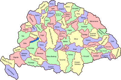
ಟೆಂಪ್ಲೇಟು:Location map Kingdom of Hungary
| name | Kingdom of Hungary | |||
|---|---|---|---|---|
| border coordinates | ||||
| 49.63 | ||||
| 14.23372306 | ←↕→ | 26.387231 | ||
| 43.72 | ||||
| map center | 46°40′30″N 20°18′38″E / 46.675°N 20.31047703°E | |||
| image | Kingdom of Hungary counties-2.svg
| |||

| ||||
The coordinates are measured off a quite good section of what appears to be a Mercator projection at File:Hungary-ethnic_groups.jpg. While this is not an equirectangular projection as expected by {{Location map}}, the distortion at these latitudes is probably small enough not to matter at this small scale.