ಚಿತ್ರ:Venezuela location map.svg

Size of this PNG preview of this SVG file: ೬೭೦ × ೫೯೯ ಪಿಕ್ಸೆಲ್ಗಳು. ಇತರ ರೆಸಲ್ಯೂಶನ್ಗಳು: ೨೬೮ × ೨೪೦ ಪಿಕ್ಸೆಲ್ಗಳು | ೫೩೭ × ೪೮೦ ಪಿಕ್ಸೆಲ್ಗಳು | ೮೫೯ × ೭೬೮ ಪಿಕ್ಸೆಲ್ಗಳು | ೧,೧೪೫ × ೧,೦೨೪ ಪಿಕ್ಸೆಲ್ಗಳು | ೨,೨೯೦ × ೨,೦೪೮ ಪಿಕ್ಸೆಲ್ಗಳು | ೧,೬೫೪ × ೧,೪೭೯ ಪಿಕ್ಸೆಲ್ಗಳು.
ಮೂಲ ಕಡತ (SVG ಫೈಲು, ಸುಮಾರಾಗಿ ೧,೬೫೪ × ೧,೪೭೯ ಚಿತ್ರಬಿಂದುಗಳು, ಫೈಲಿನ ಗಾತ್ರ: ೭೪೩ KB)
ಈ ಫೈಲು ವಿಕಿಮೀಡಿಯ ಕಾಮನ್ಸ್ನಲ್ಲಿ ಇರುವುದು. ಅಲ್ಲಿನ ವಿವರಣೆ ಪುಟವನ್ನೇ ಕೆಳಗೆ ತೋರಿಸಲಾಗಿದೆ. ಕಾಮನ್ಸ್ ಕೃತಿಸ್ವಾಮ್ಯತೆಯಿಂದ ಮುಕ್ತ ಫೈಲುಗಳ ಒಂದು ಆಗರ. ಅಲ್ಲಿ ನೀವೂ ಸಹಕರಿಸಬಹುದು. |
ಸಾರಾಂಶ
| ವಿವರ |
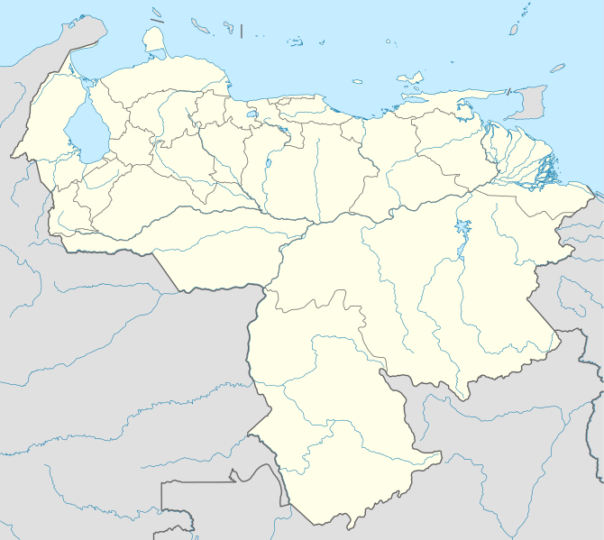
Deutsch: Positionskarte von Venezuela
Quadratische Plattkarte, N-S-Streckung 101 %. Geographische Begrenzung der Karte:
English: Location map of Venezuela
Equirectangular projection, N/S stretching 101 %. Geographic limits of the map:
|
| ದಿನಾಂಕ | |
| ಆಕರ |
ಸ್ವಂತ ಕೆಲಸ, using
|
| ಕರ್ತೃ | NordNordWest |
| ಅನುಮತಿ (ಈ ಕಡತವನ್ನು ಮರುಬಳಕೆ ಮಾಡಲಾಗುತ್ತಿದೆ) |
I, the copyright holder of this work, hereby publish it under the following license: ಈ ಕಡತ ಕ್ರಿಯೇಟಿವ್ ಕಾಮನ್ಸ್ Attribution
-Share Alike 3.0 Unported ಪರವಾನಗಿ ಹೊಂದಿದೆ.
|
| ಇತರೆ ಆವೃತ್ತಿಗಳು |
Derivative works of this file: Venezuela relief location map.jpg
|

.svg)
.jpg)

|
This map has been made or improved in the German Kartenwerkstatt (Map Lab). You can propose maps to improve as well.
|
ಕಡತದ ಇತಿಹಾಸ
ದಿನ/ಕಾಲ ಒತ್ತಿದರೆ ಆ ಸಮಯದಲ್ಲಿ ಈ ಕಡತದ ವಸ್ತುಸ್ಥಿತಿ ತೋರುತ್ತದೆ.
| ದಿನ/ಕಾಲ | ಕಿರುನೋಟ | ಆಯಾಮಗಳು | ಬಳಕೆದಾರ | ಟಿಪ್ಪಣಿ | |
|---|---|---|---|---|---|
| ಪ್ರಸಕ್ತ | ೦೧:೦೮, ೨೨ ಸೆಪ್ಟೆಂಬರ್ ೨೦೦೯ | | ೧,೬೫೪ × ೧,೪೭೯ (೭೪೩ KB) | NordNordWest | =={{int:filedesc}}== {{Information |Description= {{de|Positionskarte von Venezuela}} Quadratische Plattkarte, N-S-Streckung 101 %. Geographische Begrenzung der Karte: * N: 12.8° N * S: 0.4° N * W: 73.6° W * O: 59.6° W {{en|Location m |
ಕಡತ ಬಳಕೆ
ಈ ಕೆಳಗಿನ ಪುಟವು ಈ ಚಿತ್ರಕ್ಕೆ ಸಂಪರ್ಕ ಹೊಂದಿದೆ:
ಜಾಗತಿಕ ಕಡತ ಉಪಯೋಗ
ಈ ಕಡತವನ್ನು ಕೆಳಗಿನ ಬೇರೆ ವಿಕಿಗಳೂ ಉಪಯೋಗಿಸುತ್ತಿವೆ:
- af.wikipedia.org ಮೇಲೆ ಬಳಕೆ
- als.wikipedia.org ಮೇಲೆ ಬಳಕೆ
- am.wikipedia.org ಮೇಲೆ ಬಳಕೆ
- an.wikipedia.org ಮೇಲೆ ಬಳಕೆ
- Caracas
- Maracaibo
- Valencia (Venezuela)
- Maracay
- Barquisimeto
- San Cristóbal (Venezuela)
- La Guaira
- Ciudat Bolívar
- Maturín
- Mérida (Venezuela)
- Los Teques
- Barinas (ciudat)
- Coro (Venezuela)
- San Juan de Los Morros
- La Asunción
- San Felipe (Venezuela)
- Trujillo (Venezuela)
- Puerto Ayacucho
- Cumaná
- Barcelona (Venezuela)
- Guanare
- Tucupita
- San Fernando de Apure
- San Carlos (Venezuela)
- Puerto La Cruz
- Puerto Cabello
- Ciudat Guayana
- San Fernando de Atabapo
- Ciudat Ojeda
- Cabimas
- Lechería
- Isla Ratón
- Plantilla:Mapa de localización Venezuela
- Guasdualito
- Colonia Tovar
- Urica
- ast.wikipedia.org ಮೇಲೆ ಬಳಕೆ
- awa.wikipedia.org ಮೇಲೆ ಬಳಕೆ
- az.wikipedia.org ಮೇಲೆ ಬಳಕೆ
- ba.wikipedia.org ಮೇಲೆ ಬಳಕೆ
ಈ ಫೈಲ್ನ ಹೆಚ್ಚು ಜಾಗತಿಕ ಬಳಕೆಯನ್ನು ವೀಕ್ಷಿಸಿ.