ಚಿತ್ರ:Sheffield outline map with UK.svg

Size of this PNG preview of this SVG file: ೬೧೨ × ೪೩೭ ಪಿಕ್ಸೆಲ್ಗಳು. ಇತರ ರೆಸಲ್ಯೂಶನ್ಗಳು: ೩೨೦ × ೨೨೮ ಪಿಕ್ಸೆಲ್ಗಳು | ೬೪೦ × ೪೫೭ ಪಿಕ್ಸೆಲ್ಗಳು | ೧,೦೨೪ × ೭೩೧ ಪಿಕ್ಸೆಲ್ಗಳು | ೧,೨೮೦ × ೯೧೪ ಪಿಕ್ಸೆಲ್ಗಳು | ೨,೫೬೦ × ೧,೮೨೮ ಪಿಕ್ಸೆಲ್ಗಳು.
ಮೂಲ ಕಡತ (SVG ಫೈಲು, ಸುಮಾರಾಗಿ ೬೧೨ × ೪೩೭ ಚಿತ್ರಬಿಂದುಗಳು, ಫೈಲಿನ ಗಾತ್ರ: ೮೦೮ KB)
ಈ ಫೈಲು ವಿಕಿಮೀಡಿಯ ಕಾಮನ್ಸ್ನಲ್ಲಿ ಇರುವುದು. ಅಲ್ಲಿನ ವಿವರಣೆ ಪುಟವನ್ನೇ ಕೆಳಗೆ ತೋರಿಸಲಾಗಿದೆ. ಕಾಮನ್ಸ್ ಕೃತಿಸ್ವಾಮ್ಯತೆಯಿಂದ ಮುಕ್ತ ಫೈಲುಗಳ ಒಂದು ಆಗರ. ಅಲ್ಲಿ ನೀವೂ ಸಹಕರಿಸಬಹುದು. |
ಸಾರಾಂಶ
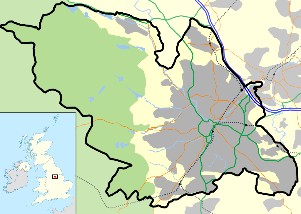
| ವಿವರ | Sheffield outline, showing motorways and urban areas. |
| ದಿನಾಂಕ | |
| ಆಕರ | Mapping is derived from Open Street Map data, which is licensed under a creative commons attribution sharealike licence. UK outline is File:Uk outline map.png, which is licensed under the GFDL. |
| ಕರ್ತೃ | JeremyA |
| ಅನುಮತಿ (ಈ ಕಡತವನ್ನು ಮರುಬಳಕೆ ಮಾಡಲಾಗುತ್ತಿದೆ) |
Permission is granted for reuse only under the terms of the below licence. |
| SVG genesis |
This vector image includes elements that have been taken or adapted from this file:
ಪರವಾನಗಿ
I, the copyright holder of this work, hereby publish it under the following license:
This file is licensed under the Creative Commons Attribution-Share Alike 2.0 Generic license.
- ನೀವು ಮುಕ್ತ:
- ಹಂಚಿಕೆಗೆ – ಕೆಲಸವನ್ನು ನಕಲು ಮಾಡಲು, ವಿತರಣೆ ಮತ್ತು ಸಾಗಿಸಲು
- ರೀಮಿಕ್ಸ್ ಮಾಡಲು – ಕೆಲಸವನ್ನು ಬಳಸಿಕೊಳ್ಳಲು
- ಈ ಕೆಳಗಿನ ಷರತ್ತುಗಳಲ್ಲಿ:
- ವೈಶಿಷ್ಟ್ಯ – ನೀವು ಸೂಕ್ತವಾದ ಕ್ರೆಡಿಟ್ ನೀಡಬೇಕು, ಪರವಾನಗಿಗೆ ಲಿಂಕ್ ಅನ್ನು ಒದಗಿಸಬೇಕು ಮತ್ತು ಯಾವುದೇ ಬದಲಾವಣೆಗಳನ್ನು ಮಾಡಿದ್ದರೆ ಸೂಚಿಸಬೇಕು. ನೀವು ಯಾವುದೇ ಸಮಂಜಸವಾದ ರೀತಿಯಲ್ಲಿ ಮಾಡಬಹುದು, ಆದರೆ ಪರವಾನಗಿದಾರರು ನಿಮ್ಮನ್ನು ಅಥವಾ ನಿಮ್ಮ ಯಾವುದೇ ಬಳಕೆಯನ್ನು ಅನುಮೋದಿಸಿದಂತೆ ರೀತಿಯಲ್ಲಿ ಉಪಯೋಗಿಸಬಾರದು.
- ಇರುವುದರಂತೆಯೇ ಹಂಚು – ನೀವು ರೀಮಿಕ್ಸ್ ಮಾಡಿದರೆ, ರೂಪಾಂತರಗೊಳಿಸಿದರೆ ಅಥವಾ ವಸ್ತುವಿನ ಮೇಲೆ ನಿರ್ಮಿಸಿದರೆ, ನಿಮ್ಮ ಕೊಡುಗೆಗಳನ್ನು ನೀವು ಮೂಲದಂತೆ ಅದೇ ಅಥವಾ ಹೊಂದಾಣಿಕೆಯ ಪರವಾನಗಿ ಅಡಿಯಲ್ಲಿ ವಿತರಿಸಬೇಕು.
ಕಡತದ ಇತಿಹಾಸ
ದಿನ/ಕಾಲ ಒತ್ತಿದರೆ ಆ ಸಮಯದಲ್ಲಿ ಈ ಕಡತದ ವಸ್ತುಸ್ಥಿತಿ ತೋರುತ್ತದೆ.
| ದಿನ/ಕಾಲ | ಕಿರುನೋಟ | ಆಯಾಮಗಳು | ಬಳಕೆದಾರ | ಟಿಪ್ಪಣಿ | |
|---|---|---|---|---|---|
| ಪ್ರಸಕ್ತ | ೨೧:೦೭, ೭ ಅಕ್ಟೋಬರ್ ೨೦೧೨ | | ೬೧೨ × ೪೩೭ (೮೦೮ KB) | Cwbm (commons) | replaced raster graphic with vector file |
| ೦೪:೦೫, ೩೦ ಏಪ್ರಿಲ್ ೨೦೦೭ |  | ೬೧೨ × ೪೩೭ (೧೩೫ KB) | JeremyA |
ಕಡತ ಬಳಕೆ
ಈ ಕೆಳಗಿನ ಪುಟವು ಈ ಚಿತ್ರಕ್ಕೆ ಸಂಪರ್ಕ ಹೊಂದಿದೆ:
ಜಾಗತಿಕ ಕಡತ ಉಪಯೋಗ
ಈ ಕಡತವನ್ನು ಕೆಳಗಿನ ಬೇರೆ ವಿಕಿಗಳೂ ಉಪಯೋಗಿಸುತ್ತಿವೆ:
- ar.wikipedia.org ಮೇಲೆ ಬಳಕೆ
- ceb.wikipedia.org ಮೇಲೆ ಬಳಕೆ
- el.wikipedia.org ಮೇಲೆ ಬಳಕೆ
- en.wikipedia.org ಮೇಲೆ ಬಳಕೆ
- Hillsborough disaster
- Hillsborough Stadium
- Attercliffe
- Hallamshire
- Hillsborough (ward)
- High Bradfield
- Low Bradfield
- Sheffield Cathedral
- Great Sheffield Flood
- Cathedral Church of St Marie, Sheffield
- Bramall Lane
- Crosspool
- Wharncliffe Side
- Whirlow
- Ranmoor
- Gleadless
- Wadsley Bridge
- Loxley, South Yorkshire
- Pitsmoor
- Deepcar
- Oughtibridge
- East Ecclesfield
- Old Queen's Head
- Sheffield City Airport
- Chapeltown, South Yorkshire
- Listed buildings in Sheffield
- Transport in Sheffield
- Wincobank (hill fort)
- Steel City derby
- Site Gallery
- Victoria Quays
- Drama Studio, University of Sheffield
- St Mary's Church, Bramall Lane
- St George's Church, Portobello
- Norton Lees
- Millhouses and Ecclesall railway station
- High Green
- Grenoside
- Sheffield City Centre
- Millhouses Park
- Dale Dike Reservoir
- Module:Location map/data/United Kingdom Sheffield/doc
- Madina Mosque, Sheffield
- West End, Sheffield
- Bolsterstone
ಈ ಫೈಲ್ನ ಹೆಚ್ಚು ಜಾಗತಿಕ ಬಳಕೆಯನ್ನು ವೀಕ್ಷಿಸಿ.