ಚಿತ್ರ:Relief Map of Latvia.jpg

ಈ ಮುನ್ನೋಟ ಗಾತ್ರ:೮೦೦ × ೫೦೪ ಪಿಕ್ಸೆಲ್ಗಳು. ಇತರ ರೆಸಲ್ಯೂಶನ್ಗಳು: ೩೨೦ × ೨೦೨ ಪಿಕ್ಸೆಲ್ಗಳು | ೬೪೦ × ೪೦೩ ಪಿಕ್ಸೆಲ್ಗಳು | ೧,೨೦೦ × ೭೫೬ ಪಿಕ್ಸೆಲ್ಗಳು.
ಮೂಲ ಕಡತ (೧,೨೦೦ × ೭೫೬ ಚಿತ್ರಬಿಂದು, ಫೈಲಿನ ಗಾತ್ರ: ೩೦೯ KB, MIME ಪ್ರಕಾರ: image/jpeg)
ಈ ಫೈಲು ವಿಕಿಮೀಡಿಯ ಕಾಮನ್ಸ್ನಲ್ಲಿ ಇರುವುದು. ಅಲ್ಲಿನ ವಿವರಣೆ ಪುಟವನ್ನೇ ಕೆಳಗೆ ತೋರಿಸಲಾಗಿದೆ. ಕಾಮನ್ಸ್ ಕೃತಿಸ್ವಾಮ್ಯತೆಯಿಂದ ಮುಕ್ತ ಫೈಲುಗಳ ಒಂದು ಆಗರ. ಅಲ್ಲಿ ನೀವೂ ಸಹಕರಿಸಬಹುದು. |
ಸಾರಾಂಶ
| ವಿವರ |
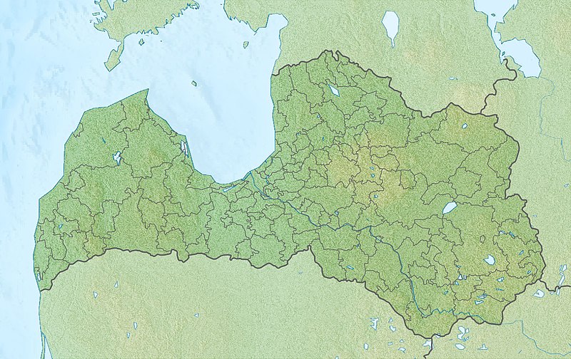
English: Location map of Latvia Equirectangular projection, N/S stretching 170 %. Geographic limits of the map:
|
| ದಿನಾಂಕ | (UTC) |
| ಆಕರ |
|
| ಕರ್ತೃ |
|
| This is a retouched picture, which means that it has been digitally altered from its original version. The original can be viewed here: Latvia location map.svg:
|
ಪರವಾನಗಿ
I, the copyright holder of this work, hereby publish it under the following licenses:
ಈ ಕಡತ ಕ್ರಿಯೇಟಿವ್ ಕಾಮನ್ಸ್ Attribution
-Share Alike 3.0 Unported ಪರವಾನಗಿ ಹೊಂದಿದೆ.
- ನೀವು ಮುಕ್ತ:
- ಹಂಚಿಕೆಗೆ – ಕೆಲಸವನ್ನು ನಕಲು ಮಾಡಲು, ವಿತರಣೆ ಮತ್ತು ಸಾಗಿಸಲು
- ರೀಮಿಕ್ಸ್ ಮಾಡಲು – ಕೆಲಸವನ್ನು ಬಳಸಿಕೊಳ್ಳಲು
- ಈ ಕೆಳಗಿನ ಷರತ್ತುಗಳಲ್ಲಿ:
- ವೈಶಿಷ್ಟ್ಯ – ನೀವು ಸೂಕ್ತವಾದ ಕ್ರೆಡಿಟ್ ನೀಡಬೇಕು, ಪರವಾನಗಿಗೆ ಲಿಂಕ್ ಅನ್ನು ಒದಗಿಸಬೇಕು ಮತ್ತು ಯಾವುದೇ ಬದಲಾವಣೆಗಳನ್ನು ಮಾಡಿದ್ದರೆ ಸೂಚಿಸಬೇಕು. ನೀವು ಯಾವುದೇ ಸಮಂಜಸವಾದ ರೀತಿಯಲ್ಲಿ ಮಾಡಬಹುದು, ಆದರೆ ಪರವಾನಗಿದಾರರು ನಿಮ್ಮನ್ನು ಅಥವಾ ನಿಮ್ಮ ಯಾವುದೇ ಬಳಕೆಯನ್ನು ಅನುಮೋದಿಸಿದಂತೆ ರೀತಿಯಲ್ಲಿ ಉಪಯೋಗಿಸಬಾರದು.
- ಇರುವುದರಂತೆಯೇ ಹಂಚು – ನೀವು ರೀಮಿಕ್ಸ್ ಮಾಡಿದರೆ, ರೂಪಾಂತರಗೊಳಿಸಿದರೆ ಅಥವಾ ವಸ್ತುವಿನ ಮೇಲೆ ನಿರ್ಮಿಸಿದರೆ, ನಿಮ್ಮ ಕೊಡುಗೆಗಳನ್ನು ನೀವು ಮೂಲದಂತೆ ಅದೇ ಅಥವಾ ಹೊಂದಾಣಿಕೆಯ ಪರವಾನಗಿ ಅಡಿಯಲ್ಲಿ ವಿತರಿಸಬೇಕು.

|
GNU ಉಚಿತ ಡಾಕ್ಯುಮೆಂಟೇಶನ್ ಪರವಾನಗಿ, ಆವೃತ್ತಿಯ ನಿಯಮಗಳ ಅಡಿಯಲ್ಲಿ ಈ ಡಾಕ್ಯುಮೆಂಟ್ ಅನ್ನು ನಕಲಿಸಲು, ವಿತರಿಸಲು ಮತ್ತು/ಅಥವಾ ಮಾರ್ಪಡಿಸಲು ಅನುಮತಿಯನ್ನು ನೀಡಲಾಗಿದೆ. 1.2 ಅಥವಾ ಯಾವುದೇ ನಂತರದ ಆವೃತ್ತಿಯನ್ನು ಉಚಿತ ಸಾಫ್ಟ್ವೇರ್ ಫೌಂಡೇಶನ್ ಪ್ರಕಟಿಸಿದೆ; ಯಾವುದೇ ಅಸ್ಥಿರ ವಿಭಾಗಗಳಿಲ್ಲದೆ, ಮುಖ ಪಠ್ಯಗಳಿಲ್ಲ ಮತ್ತು ಹಿಂದಿನ ಕವರ್ ಪಠ್ಯಗಳಿಲ್ಲ. ಪರವಾನಗಿಯ ಪ್ರತಿಯನ್ನು GNU ಉಚಿತ ಡಾಕ್ಯುಮೆಂಟೇಶನ್ ಪರವಾನಗಿ ಎಂಬ ವಿಭಾಗದಲ್ಲಿ ಸೇರಿಸಲಾಗಿದೆ. |
ನಿಮ್ಮಿಚ್ಛೆಯ ಪರವಾನಗಿಯನ್ನು ನೀವು ಆರಿಸಿಕೊಳ್ಳಬಹುದು.
Original upload log
This image is a derivative work of the following images:
- File:Latvia_location_map.svg licensed with Cc-by-sa-3.0, GFDL
- 2009-07-04T13:16:32Z Gleb Borisov 1305x822 (367838 Bytes) from July 1 the political map of Latvia is like that
- 2009-02-12T10:14:18Z NordNordWest 1305x822 (256639 Bytes) boundaries stay the same until July 2009
- 2008-12-31T17:54:15Z NordNordWest 1305x822 (367838 Bytes)
- 2008-08-29T08:07:14Z NordNordWest 1305x822 (256639 Bytes)
- 2008-07-17T21:18:06Z NordNordWest 652x411 (254520 Bytes) {{Information |Description= {{de|Positionskarte von [[:de:Lettland|Lettland]]}} Quadratische Plattkarte, N-S-Streckung 170 %. Geographische Begrenzung der Karte: * N: 58.5° N * S: 55.5° N * W: 20.5° O * O: 28.6° O {{en|Lo
Uploaded with derivativeFX
ಕಡತದ ಇತಿಹಾಸ
ದಿನ/ಕಾಲ ಒತ್ತಿದರೆ ಆ ಸಮಯದಲ್ಲಿ ಈ ಕಡತದ ವಸ್ತುಸ್ಥಿತಿ ತೋರುತ್ತದೆ.
| ದಿನ/ಕಾಲ | ಕಿರುನೋಟ | ಆಯಾಮಗಳು | ಬಳಕೆದಾರ | ಟಿಪ್ಪಣಿ | |
|---|---|---|---|---|---|
| ಪ್ರಸಕ್ತ | ೨೩:೦೨, ೨೭ ನವೆಂಬರ್ ೨೦೧೦ | | ೧,೨೦೦ × ೭೫೬ (೩೦೯ KB) | Виктор В | {{Information |Description={{en|Location map of Latvia}} Equirectangular projection, N/S stretching 170 %. Geographic limits of the map: * N: 58.5° N * S: 55.5° N * W: 20.5° E * E: 28.6° E |Source=*[[:File:Latvia_location_map.svg|] |
ಕಡತ ಬಳಕೆ
ಈ ಕೆಳಗಿನ ಪುಟವು ಈ ಚಿತ್ರಕ್ಕೆ ಸಂಪರ್ಕ ಹೊಂದಿದೆ:
ಜಾಗತಿಕ ಕಡತ ಉಪಯೋಗ
ಈ ಕಡತವನ್ನು ಕೆಳಗಿನ ಬೇರೆ ವಿಕಿಗಳೂ ಉಪಯೋಗಿಸುತ್ತಿವೆ:
- an.wikipedia.org ಮೇಲೆ ಬಳಕೆ
- ar.wikipedia.org ಮೇಲೆ ಬಳಕೆ
- ast.wikipedia.org ಮೇಲೆ ಬಳಕೆ
- az.wikipedia.org ಮೇಲೆ ಬಳಕೆ
- Qauya Milli Parkı
- Şablon:Yer xəritəsi Latviya
- Kemeri Milli Parkı
- Doles yarımadası
- Kolkasraqs burnu
- Teyçi qoruğu
- Venta şəlaləsi
- Slitere Milli Parkı
- Lusavsala
- Latviyanın Milli Botanika Bağı
- Raznas Milli Parkı
- Şimali Vidzeme Biosfer Qoruğu
- Qutman mağarası
- Ventspils Beynəlxalq Radioastronomiya Mərkəzi
- Riqa SES
- bn.wikipedia.org ಮೇಲೆ ಬಳಕೆ
- bs.wikipedia.org ಮೇಲೆ ಬಳಕೆ
- ca.wikipedia.org ಮೇಲೆ ಬಳಕೆ
- ceb.wikipedia.org ಮೇಲೆ ಬಳಕೆ
- ce.wikipedia.org ಮೇಲೆ ಬಳಕೆ
- ckb.wikipedia.org ಮೇಲೆ ಬಳಕೆ
- cs.wikipedia.org ಮೇಲೆ ಬಳಕೆ
- da.wikipedia.org ಮೇಲೆ ಬಳಕೆ
- el.wikipedia.org ಮೇಲೆ ಬಳಕೆ
- en.wikipedia.org ಮೇಲೆ ಬಳಕೆ
ಈ ಫೈಲ್ನ ಹೆಚ್ಚು ಜಾಗತಿಕ ಬಳಕೆಯನ್ನು ವೀಕ್ಷಿಸಿ.