ಚಿತ್ರ:Ramnagar fort.JPG

ಈ ಮುನ್ನೋಟ ಗಾತ್ರ:೮೦೦ × ೫೬೩ ಪಿಕ್ಸೆಲ್ಗಳು. ಇತರ ರೆಸಲ್ಯೂಶನ್ಗಳು: ೩೨೦ × ೨೨೫ ಪಿಕ್ಸೆಲ್ಗಳು | ೬೪೦ × ೪೫೧ ಪಿಕ್ಸೆಲ್ಗಳು | ೧,೦೨೪ × ೭೨೧ ಪಿಕ್ಸೆಲ್ಗಳು | ೧,೨೮೦ × ೯೦೧ ಪಿಕ್ಸೆಲ್ಗಳು | ೨,೫೬೦ × ೧,೮೦೩ ಪಿಕ್ಸೆಲ್ಗಳು | ೪,೬೦೮ × ೩,೨೪೫ ಪಿಕ್ಸೆಲ್ಗಳು.
ಮೂಲ ಕಡತ (೪,೬೦೮ × ೩,೨೪೫ ಚಿತ್ರಬಿಂದು, ಫೈಲಿನ ಗಾತ್ರ: ೨.೩೬ MB, MIME ಪ್ರಕಾರ: image/jpeg)
ಈ ಫೈಲು ವಿಕಿಮೀಡಿಯ ಕಾಮನ್ಸ್ನಲ್ಲಿ ಇರುವುದು. ಅಲ್ಲಿನ ವಿವರಣೆ ಪುಟವನ್ನೇ ಕೆಳಗೆ ತೋರಿಸಲಾಗಿದೆ. ಕಾಮನ್ಸ್ ಕೃತಿಸ್ವಾಮ್ಯತೆಯಿಂದ ಮುಕ್ತ ಫೈಲುಗಳ ಒಂದು ಆಗರ. ಅಲ್ಲಿ ನೀವೂ ಸಹಕರಿಸಬಹುದು. |
ಸಾರಾಂಶ
| ವಿವರ |
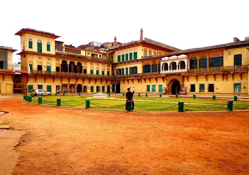
English: It is located near the Ganges River on its eastern bank, opposite to the Tulsi Ghat. The structure was built in 1750 by Kashi Naresh Raja Balwant Singh with cream coloured chunar sandstone. |
| ದಿನಾಂಕ | |
| ಆಕರ | https://www.panoramio.com/user/vsvinaykumar |
| ಕರ್ತೃ | vsvinaykumar |
| Camera location | | View this and other nearby images on: OpenStreetMap |
|---|
ಪರವಾನಗಿ

|
The copyright holder of this file allows anyone to use it for any purpose, provided that the copyright holder is properly attributed. Redistribution, derivative work, commercial use, and all other use is permitted. |
|
|
ಕಡತದ ಇತಿಹಾಸ
ದಿನ/ಕಾಲ ಒತ್ತಿದರೆ ಆ ಸಮಯದಲ್ಲಿ ಈ ಕಡತದ ವಸ್ತುಸ್ಥಿತಿ ತೋರುತ್ತದೆ.
| ದಿನ/ಕಾಲ | ಕಿರುನೋಟ | ಆಯಾಮಗಳು | ಬಳಕೆದಾರ | ಟಿಪ್ಪಣಿ | |
|---|---|---|---|---|---|
| ಪ್ರಸಕ್ತ | ೦೦:೨೧, ೧೭ ಡಿಸೆಂಬರ್ ೨೦೧೩ | | ೪,೬೦೮ × ೩,೨೪೫ (೨.೩೬ MB) | Cropbot | upload cropped version, operated by User:Andy king50. Summary: cropped |
| ೧೪:೪೭, ೯ ಆಗಸ್ಟ್ ೨೦೧೩ |  | ೪,೬೦೮ × ೩,೪೫೬ (೧.೮೨ MB) | Vsvinaykumar2 | User created page with UploadWizard |
ಕಡತ ಬಳಕೆ
ಈ ಕೆಳಗಿನ ಪುಟವು ಈ ಚಿತ್ರಕ್ಕೆ ಸಂಪರ್ಕ ಹೊಂದಿದೆ:
ಜಾಗತಿಕ ಕಡತ ಉಪಯೋಗ
ಈ ಕಡತವನ್ನು ಕೆಳಗಿನ ಬೇರೆ ವಿಕಿಗಳೂ ಉಪಯೋಗಿಸುತ್ತಿವೆ:
- en.wikipedia.org ಮೇಲೆ ಬಳಕೆ
- es.wikipedia.org ಮೇಲೆ ಬಳಕೆ
- id.wikipedia.org ಮೇಲೆ ಬಳಕೆ
- ja.wikipedia.org ಮೇಲೆ ಬಳಕೆ
- ta.wikipedia.org ಮೇಲೆ ಬಳಕೆ