ಚಿತ್ರ:Région métropolitaine de Montréal-blank.svg

Size of this PNG preview of this SVG file: ೬೬೧ × ೫೯೯ ಪಿಕ್ಸೆಲ್ಗಳು. ಇತರ ರೆಸಲ್ಯೂಶನ್ಗಳು: ೨೬೫ × ೨೪೦ ಪಿಕ್ಸೆಲ್ಗಳು | ೫೩೦ × ೪೮೦ ಪಿಕ್ಸೆಲ್ಗಳು | ೮೪೭ × ೭೬೮ ಪಿಕ್ಸೆಲ್ಗಳು | ೧,೧೩೦ × ೧,೦೨೪ ಪಿಕ್ಸೆಲ್ಗಳು | ೨,೨೫೯ × ೨,೦೪೮ ಪಿಕ್ಸೆಲ್ಗಳು | ೧,೬೬೭ × ೧,೫೧೧ ಪಿಕ್ಸೆಲ್ಗಳು.
ಮೂಲ ಕಡತ (SVG ಫೈಲು, ಸುಮಾರಾಗಿ ೧,೬೬೭ × ೧,೫೧೧ ಚಿತ್ರಬಿಂದುಗಳು, ಫೈಲಿನ ಗಾತ್ರ: ೩೦೨ KB)
ಈ ಫೈಲು ವಿಕಿಮೀಡಿಯ ಕಾಮನ್ಸ್ನಲ್ಲಿ ಇರುವುದು. ಅಲ್ಲಿನ ವಿವರಣೆ ಪುಟವನ್ನೇ ಕೆಳಗೆ ತೋರಿಸಲಾಗಿದೆ. ಕಾಮನ್ಸ್ ಕೃತಿಸ್ವಾಮ್ಯತೆಯಿಂದ ಮುಕ್ತ ಫೈಲುಗಳ ಒಂದು ಆಗರ. ಅಲ್ಲಿ ನೀವೂ ಸಹಕರಿಸಬಹುದು. |
ಸಾರಾಂಶ
| ವಿವರ |
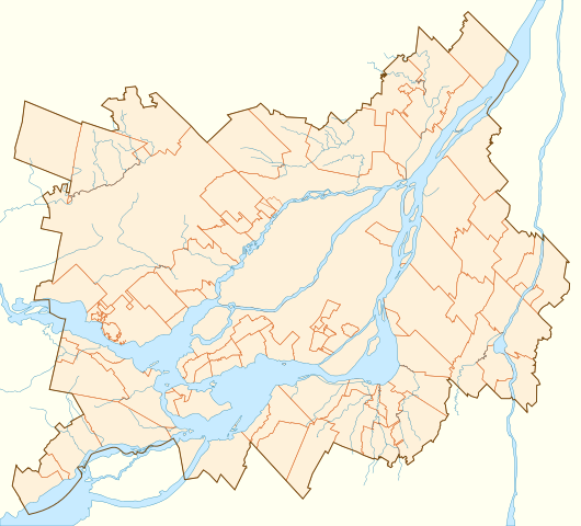
Français : Carte vierge de la région métropolitaine de Montréal, affichant son contour, le découpage des municipalités qui la composent, et ses principaux cours d'eau.
Projection conique conforme de Lambert |
||
| ದಿನಾಂಕ | |||
| ಆಕರ | D'après la carte Secteur de recensement selon RMR / AR de Montréal (lien), 12 décembre 2011. | ||
| ಕರ್ತೃ | Flappiefh | ||
| ಇತರೆ ಆವೃತ್ತಿಗಳು | |||
| SVG | W3C-validity not checked.
|
||
| Graphic Lab |

ಪರವಾನಗಿ
I, the copyright holder of this work, hereby publish it under the following license:
ಈ ಕಡತ ಕ್ರಿಯೇಟಿವ್ ಕಾಮನ್ಸ್ Attribution
-Share Alike 3.0 Unported ಪರವಾನಗಿ ಹೊಂದಿದೆ.
- ನೀವು ಮುಕ್ತ:
- ಹಂಚಿಕೆಗೆ – ಕೆಲಸವನ್ನು ನಕಲು ಮಾಡಲು, ವಿತರಣೆ ಮತ್ತು ಸಾಗಿಸಲು
- ರೀಮಿಕ್ಸ್ ಮಾಡಲು – ಕೆಲಸವನ್ನು ಬಳಸಿಕೊಳ್ಳಲು
- ಈ ಕೆಳಗಿನ ಷರತ್ತುಗಳಲ್ಲಿ:
- ವೈಶಿಷ್ಟ್ಯ – ನೀವು ಸೂಕ್ತವಾದ ಕ್ರೆಡಿಟ್ ನೀಡಬೇಕು, ಪರವಾನಗಿಗೆ ಲಿಂಕ್ ಅನ್ನು ಒದಗಿಸಬೇಕು ಮತ್ತು ಯಾವುದೇ ಬದಲಾವಣೆಗಳನ್ನು ಮಾಡಿದ್ದರೆ ಸೂಚಿಸಬೇಕು. ನೀವು ಯಾವುದೇ ಸಮಂಜಸವಾದ ರೀತಿಯಲ್ಲಿ ಮಾಡಬಹುದು, ಆದರೆ ಪರವಾನಗಿದಾರರು ನಿಮ್ಮನ್ನು ಅಥವಾ ನಿಮ್ಮ ಯಾವುದೇ ಬಳಕೆಯನ್ನು ಅನುಮೋದಿಸಿದಂತೆ ರೀತಿಯಲ್ಲಿ ಉಪಯೋಗಿಸಬಾರದು.
- ಇರುವುದರಂತೆಯೇ ಹಂಚು – ನೀವು ರೀಮಿಕ್ಸ್ ಮಾಡಿದರೆ, ರೂಪಾಂತರಗೊಳಿಸಿದರೆ ಅಥವಾ ವಸ್ತುವಿನ ಮೇಲೆ ನಿರ್ಮಿಸಿದರೆ, ನಿಮ್ಮ ಕೊಡುಗೆಗಳನ್ನು ನೀವು ಮೂಲದಂತೆ ಅದೇ ಅಥವಾ ಹೊಂದಾಣಿಕೆಯ ಪರವಾನಗಿ ಅಡಿಯಲ್ಲಿ ವಿತರಿಸಬೇಕು.
ಕಡತದ ಇತಿಹಾಸ
ದಿನ/ಕಾಲ ಒತ್ತಿದರೆ ಆ ಸಮಯದಲ್ಲಿ ಈ ಕಡತದ ವಸ್ತುಸ್ಥಿತಿ ತೋರುತ್ತದೆ.
| ದಿನ/ಕಾಲ | ಕಿರುನೋಟ | ಆಯಾಮಗಳು | ಬಳಕೆದಾರ | ಟಿಪ್ಪಣಿ | |
|---|---|---|---|---|---|
| ಪ್ರಸಕ್ತ | ೧೭:೫೮, ೨೨ ಮೇ ೨೦೧೪ | | ೧,೬೬೭ × ೧,೫೧೧ (೩೦೨ KB) | Sémhur | Valid SVG |
| ೦೨:೧೨, ೪ ಸೆಪ್ಟೆಂಬರ್ ೨೦೧೩ |  | ೧,೬೬೭ × ೧,೫೧೧ (೩೦೨ KB) | Sémhur | Eau en bleu #C8EBFF | |
| ೦೩:೩೩, ೨೯ ಜುಲೈ ೨೦೧೨ |  | ೧,೬೬೭ × ೧,೫೧೧ (೩೨೮ KB) | Flappiefh | La carte précédente était inclinée de 3,8° par rapport au nord. Corrigé. | |
| ೨೨:೧೪, ೨೭ ಜುಲೈ ೨೦೧೨ |  | ೧,೬೯೪ × ೧,೪೧೬ (೩೪೬ KB) | Flappiefh | Rotation de 3.8° (le Nord est désormais aligné avec les bords de la carte). Correction des cours d'eau. | |
| ೧೩:೪೩, ೨೧ ಜುಲೈ ೨೦೧೨ |  | ೧,೭೧೪ × ೧,೫೨೬ (೩೩೧ KB) | Flappiefh | Ajustement des cours d'eau et des bords du Saint-Laurent. | |
| ೧೩:೧೯, ೨೧ ಜುಲೈ ೨೦೧೨ |  | ೧,೭೧೪ × ೧,೫೨೬ (೩೩೦ KB) | Flappiefh |
ಕಡತ ಬಳಕೆ
ಈ ಕೆಳಗಿನ 2 ಪುಟಗಳು ಈ ಚಿತ್ರಕ್ಕೆ ಸಂಪರ್ಕ ಹೊಂದಿವೆ:
ಜಾಗತಿಕ ಕಡತ ಉಪಯೋಗ
ಈ ಕಡತವನ್ನು ಕೆಳಗಿನ ಬೇರೆ ವಿಕಿಗಳೂ ಉಪಯೋಗಿಸುತ್ತಿವೆ:
- en.wikipedia.org ಮೇಲೆ ಬಳಕೆ
- Terrebonne, Quebec
- Kanesatake
- Le Moyne, Quebec
- Cosmodome
- Laflèche, Quebec
- 2007 Presidents Cup
- Country Club of Montreal
- Hôpital Charles-LeMoyne
- Hôpital Pierre Boucher
- Parc Michel-Chartrand
- Module:Location map/data/Canada Greater Montreal/doc
- Parc de la Cité
- Boisé du Tremblay
- 2015 Première ligue de soccer du Québec season
- Clock Tower Beach
- Module:Location map/data/Canada Greater Montreal
- The Ring (Montreal)
- eo.wikipedia.org ಮೇಲೆ ಬಳಕೆ
- Mascouche (Kebekio)
- Internacia Aera Transporta Asocio
- Universitato McGill
- Festival International de Jazz de Montréal
- Fondumo por Esperantologiaj Studoj
- Juste pour rire
- Universitato Concordia
- Oratorio Sankta Jozefo
- Berri-UQAM (metroo de Montrealo)
- Snowdon (metroo de Montrealo)
- Jean-Talon (metroo de Montrealo)
- Ŝablono:Situo sur mapo Kanado Montrealo
- Lionel-Groulx (metroo de Montrealo)
- Angrignon (metroo de Montrealo)
- Honoré-Beaugrand (metroo de Montrealo)
- Côte-Vertu (metroo de Montrealo)
- Montmorency (metroo de Montrealo)
- Saint-Michel (metroo de Montrealo)
- Longueuil–Université-de-Sherbrooke (metroo de Montrealo)
- Jean-Drapeau (metroo de Montrealo)
- Guy-Concordia (metroo de Montrealo)
- McGill (metroo de Montrealo)
- Atwater (metroo de Montrealo)
- Frontenac (metroo de Montrealo)
- Pie-IX (metroo de Montrealo)
- Viau (metroo de Montrealo)
- Joliette (metroo de Montrealo)
- Place-Saint-Henri (metroo de Montrealo)
- Vendôme (metroo de Montrealo)
- Lucien-L'Allier (metroo de Montrealo)
- Bonaventure (metroo de Montrealo)
- Sauvé (metroo de Montrealo)
- De la Concorde (metroo de Montrealo)
ಈ ಫೈಲ್ನ ಹೆಚ್ಚು ಜಾಗತಿಕ ಬಳಕೆಯನ್ನು ವೀಕ್ಷಿಸಿ.