ಚಿತ್ರ:Outer Hebrides UK location map.svg

Size of this PNG preview of this SVG file: ೪೫೬ × ೬೦೦ ಪಿಕ್ಸೆಲ್ಗಳು. ಇತರ ರೆಸಲ್ಯೂಶನ್ಗಳು: ೧೮೨ × ೨೪೦ ಪಿಕ್ಸೆಲ್ಗಳು | ೩೬೫ × ೪೮೦ ಪಿಕ್ಸೆಲ್ಗಳು | ೫೮೪ × ೭೬೮ ಪಿಕ್ಸೆಲ್ಗಳು | ೭೭೯ × ೧,೦೨೪ ಪಿಕ್ಸೆಲ್ಗಳು | ೧,೫೫೭ × ೨,೦೪೮ ಪಿಕ್ಸೆಲ್ಗಳು | ೧,೦೮೩ × ೧,೪೨೪ ಪಿಕ್ಸೆಲ್ಗಳು.
ಮೂಲ ಕಡತ (SVG ಫೈಲು, ಸುಮಾರಾಗಿ ೧,೦೮೩ × ೧,೪೨೪ ಚಿತ್ರಬಿಂದುಗಳು, ಫೈಲಿನ ಗಾತ್ರ: ೩.೨೫ MB)
ಈ ಫೈಲು ವಿಕಿಮೀಡಿಯ ಕಾಮನ್ಸ್ನಲ್ಲಿ ಇರುವುದು. ಅಲ್ಲಿನ ವಿವರಣೆ ಪುಟವನ್ನೇ ಕೆಳಗೆ ತೋರಿಸಲಾಗಿದೆ. ಕಾಮನ್ಸ್ ಕೃತಿಸ್ವಾಮ್ಯತೆಯಿಂದ ಮುಕ್ತ ಫೈಲುಗಳ ಒಂದು ಆಗರ. ಅಲ್ಲಿ ನೀವೂ ಸಹಕರಿಸಬಹುದು. |
| ವಿವರ |
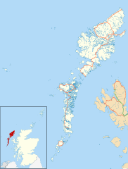
Blank map of the Outer Hebrides (excluding Sula Sgeir), UK with the following information shown:
Equirectangular map projection on WGS 84 datum, with N/S stretched 180% Geographic limits:
|
| ದಿನಾಂಕ | |
| ಆಕರ |
|
| ಕರ್ತೃ | Nilfanion, created using Ordnance Survey data |
| ಅನುಮತಿ (ಈ ಕಡತವನ್ನು ಮರುಬಳಕೆ ಮಾಡಲಾಗುತ್ತಿದೆ) |
ಈ ಕಡತ ಕ್ರಿಯೇಟಿವ್ ಕಾಮನ್ಸ್ Attribution
-Share Alike 3.0 Unported ಪರವಾನಗಿ ಹೊಂದಿದೆ. ವೈಶಿಷ್ಟ್ಯ: Contains Ordnance Survey data © Crown copyright and database right
|
| ಇತರೆ ಆವೃತ್ತಿಗಳು | File:Outer Hebrides UK blank map.svg - Blank map |
ಕಡತದ ಇತಿಹಾಸ
ದಿನ/ಕಾಲ ಒತ್ತಿದರೆ ಆ ಸಮಯದಲ್ಲಿ ಈ ಕಡತದ ವಸ್ತುಸ್ಥಿತಿ ತೋರುತ್ತದೆ.
| ದಿನ/ಕಾಲ | ಕಿರುನೋಟ | ಆಯಾಮಗಳು | ಬಳಕೆದಾರ | ಟಿಪ್ಪಣಿ | |
|---|---|---|---|---|---|
| ಪ್ರಸಕ್ತ | ೦೧:೫೩, ೨೭ ಸೆಪ್ಟೆಂಬರ್ ೨೦೧೦ | | ೧,೦೮೩ × ೧,೪೨೪ (೩.೨೫ MB) | Nilfanion | {{Information |Description=Blank map of the Outer Hebrides (excluding Sula Sgeir), UK with the following information shown: *Administrative borders *Coastline, lakes and rivers *Roads and railways *Urban areas Equire |
ಕಡತ ಬಳಕೆ
ಈ ಕೆಳಗಿನ ಪುಟವು ಈ ಚಿತ್ರಕ್ಕೆ ಸಂಪರ್ಕ ಹೊಂದಿದೆ:
ಜಾಗತಿಕ ಕಡತ ಉಪಯೋಗ
ಈ ಕಡತವನ್ನು ಕೆಳಗಿನ ಬೇರೆ ವಿಕಿಗಳೂ ಉಪಯೋಗಿಸುತ್ತಿವೆ:
- ar.wikipedia.org ಮೇಲೆ ಬಳಕೆ
- bg.wikipedia.org ಮೇಲೆ ಬಳಕೆ
- ceb.wikipedia.org ಮೇಲೆ ಬಳಕೆ
- de.wikipedia.org ಮೇಲೆ ಬಳಕೆ
- en.wikipedia.org ಮೇಲೆ ಬಳಕೆ
- Outer Hebrides
- Stornoway Airport
- Lochboisdale
- Daliburgh
- Callanish
- Stornoway
- Kisimul Castle
- Uig, Lewis
- Rodel
- RRH Benbecula
- Leverburgh
- Castlebay
- Balivanich
- Cladh Hallan
- Back, Lewis
- Knock, Isle of Lewis
- Ardmore, Barra
- Ness, Lewis
- Barra Airport
- Portnaguran
- Aignish
- Dun Carloway
- Shawbost
- Gravir
- Barvas
- Garenin
- Achmore, Lewis
- Aird, Lewis
- Ardhasaig
- Balallan
- Bragar
- Lochmaddy
- Hushinish
- Carloway
- Tarbert, Harris
- Benbecula Airport
- Northbay
- Sollas
- Howmore
ಈ ಫೈಲ್ನ ಹೆಚ್ಚು ಜಾಗತಿಕ ಬಳಕೆಯನ್ನು ವೀಕ್ಷಿಸಿ.