ಚಿತ್ರ:North Yorkshire UK location map (1974-2023).svg

Size of this PNG preview of this SVG file: ೮೦೦ × ೫೮೨ ಪಿಕ್ಸೆಲ್ಗಳು. ಇತರ ರೆಸಲ್ಯೂಶನ್ಗಳು: ೩೨೦ × ೨೩೩ ಪಿಕ್ಸೆಲ್ಗಳು | ೬೪೦ × ೪೬೬ ಪಿಕ್ಸೆಲ್ಗಳು | ೧,೦೨೪ × ೭೪೫ ಪಿಕ್ಸೆಲ್ಗಳು | ೧,೨೮೦ × ೯೩೧ ಪಿಕ್ಸೆಲ್ಗಳು | ೨,೫೬೦ × ೧,೮೬೩ ಪಿಕ್ಸೆಲ್ಗಳು | ೧,೪೨೫ × ೧,೦೩೭ ಪಿಕ್ಸೆಲ್ಗಳು.
ಮೂಲ ಕಡತ (SVG ಫೈಲು, ಸುಮಾರಾಗಿ ೧,೪೨೫ × ೧,೦೩೭ ಚಿತ್ರಬಿಂದುಗಳು, ಫೈಲಿನ ಗಾತ್ರ: ೩.೨೨ MB)
ಈ ಫೈಲು ವಿಕಿಮೀಡಿಯ ಕಾಮನ್ಸ್ನಲ್ಲಿ ಇರುವುದು. ಅಲ್ಲಿನ ವಿವರಣೆ ಪುಟವನ್ನೇ ಕೆಳಗೆ ತೋರಿಸಲಾಗಿದೆ. ಕಾಮನ್ಸ್ ಕೃತಿಸ್ವಾಮ್ಯತೆಯಿಂದ ಮುಕ್ತ ಫೈಲುಗಳ ಒಂದು ಆಗರ. ಅಲ್ಲಿ ನೀವೂ ಸಹಕರಿಸಬಹುದು. |
.svg)
| ವಿವರ |
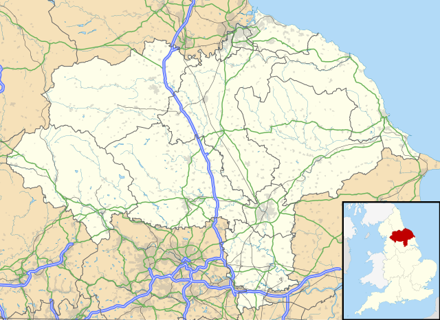
Map of North Yorkshire, UK with the following information shown:
Equirectangular map projection on WGS 84 datum, with N/S stretched 170% Geographic limits:
|
| ದಿನಾಂಕ | |
| ಆಕರ |
|
| ಕರ್ತೃ | Nilfanion, created using Ordnance Survey data |
| ಅನುಮತಿ (ಈ ಕಡತವನ್ನು ಮರುಬಳಕೆ ಮಾಡಲಾಗುತ್ತಿದೆ) |
ಈ ಕಡತ ಕ್ರಿಯೇಟಿವ್ ಕಾಮನ್ಸ್ Attribution
-Share Alike 3.0 Unported ಪರವಾನಗಿ ಹೊಂದಿದೆ. ವೈಶಿಷ್ಟ್ಯ: Contains Ordnance Survey data © Crown copyright and database right
|
| ಇತರೆ ಆವೃತ್ತಿಗಳು | File:North Yorkshire UK district map (blank).svg - Blank map |
.svg)
ಕಡತದ ಇತಿಹಾಸ
ದಿನ/ಕಾಲ ಒತ್ತಿದರೆ ಆ ಸಮಯದಲ್ಲಿ ಈ ಕಡತದ ವಸ್ತುಸ್ಥಿತಿ ತೋರುತ್ತದೆ.
| ದಿನ/ಕಾಲ | ಕಿರುನೋಟ | ಆಯಾಮಗಳು | ಬಳಕೆದಾರ | ಟಿಪ್ಪಣಿ | |
|---|---|---|---|---|---|
| ಪ್ರಸಕ್ತ | ೦೨:೦೪, ೨ ಏಪ್ರಿಲ್ ೨೦೧೮ | | ೧,೪೨೫ × ೧,೦೩೭ (೩.೨೨ MB) | Nilfanion | Update to A1 -> A1(M), other tweaks |
| ೦೦:೩೭, ೨೭ ಸೆಪ್ಟೆಂಬರ್ ೨೦೧೦ |  | ೧,೪೨೫ × ೧,೦೩೭ (೩.೧೭ MB) | Nilfanion | {{Information |Description=Map of North Yorkshire, UK with the following information shown: *Administrative borders *Coastline, lakes and rivers *Roads and railways *Urban areas Equirectangular map projection on WGS 84 datum, with N |
ಕಡತ ಬಳಕೆ
ಈ ಕೆಳಗಿನ ಪುಟವು ಈ ಚಿತ್ರಕ್ಕೆ ಸಂಪರ್ಕ ಹೊಂದಿದೆ:
ಜಾಗತಿಕ ಕಡತ ಉಪಯೋಗ
ಈ ಕಡತವನ್ನು ಕೆಳಗಿನ ಬೇರೆ ವಿಕಿಗಳೂ ಉಪಯೋಗಿಸುತ್ತಿವೆ:
- ar.wikipedia.org ಮೇಲೆ ಬಳಕೆ
- bg.wikipedia.org ಮೇಲೆ ಬಳಕೆ
- ceb.wikipedia.org ಮೇಲೆ ಬಳಕೆ
- da.wikipedia.org ಮೇಲೆ ಬಳಕೆ
- en.wikipedia.org ಮೇಲೆ ಬಳಕೆ
- es.wikipedia.org ಮೇಲೆ ಬಳಕೆ
- York
- Castillo de Howard
- Scarborough
- Ripon
- Middlesbrough
- RAF Fylingdales
- Catedral de York
- Museo de Yorkshire
- Stainforth (Yorkshire del Norte)
- Harrogate
- Plantilla:Mapa de localización de Yorkshire del Norte
- Fulford (Yorkshire del Norte)
- Tunstall (Yorkshire del Norte)
- Abadía de Whitby
- Barlby
- Appletreewick
- Skipton
- Selby
- Northallerton
- Glaisdale
- Cross Hills
- Colburn (Yorkshire del Norte)
- Ampleforth
- Alne
- Cononley
- Cowling
- Appleton Roebuck
- Darley
- Alanbrooke Barracks
- Monk Fryston
- Helperby
- High Bentham
- Hemingbrough
- Austwick
- Embsay
- East Cowton
- Easingwold
- Eggborough
- Escrick
- Bagby
- Hensall
- Hinderwell
- Sheriff Hutton
- Shipton (Yorkshire del Norte)
ಈ ಫೈಲ್ನ ಹೆಚ್ಚು ಜಾಗತಿಕ ಬಳಕೆಯನ್ನು ವೀಕ್ಷಿಸಿ.
.svg)
.svg)