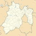
ಚಿತ್ರ:Mexico Estado de Mexico location map.svg

Size of this PNG preview of this SVG file: ೫೧೨ × ೫೧೧ ಪಿಕ್ಸೆಲ್ಗಳು. ಇತರ ರೆಸಲ್ಯೂಶನ್ಗಳು: ೨೪೦ × ೨೪೦ ಪಿಕ್ಸೆಲ್ಗಳು | ೪೮೧ × ೪೮೦ ಪಿಕ್ಸೆಲ್ಗಳು | ೭೭೦ × ೭೬೮ ಪಿಕ್ಸೆಲ್ಗಳು | ೧,೦೨೬ × ೧,೦೨೪ ಪಿಕ್ಸೆಲ್ಗಳು | ೨,೦೫೨ × ೨,೦೪೮ ಪಿಕ್ಸೆಲ್ಗಳು.
ಮೂಲ ಕಡತ (SVG ಫೈಲು, ಸುಮಾರಾಗಿ ೫೧೨ × ೫೧೧ ಚಿತ್ರಬಿಂದುಗಳು, ಫೈಲಿನ ಗಾತ್ರ: ೯೮೪ KB)
ಕಡತದ ಇತಿಹಾಸ
ದಿನ/ಕಾಲ ಒತ್ತಿದರೆ ಆ ಸಮಯದಲ್ಲಿ ಈ ಕಡತದ ವಸ್ತುಸ್ಥಿತಿ ತೋರುತ್ತದೆ.
| ದಿನ/ಕಾಲ | ಕಿರುನೋಟ | ಆಯಾಮಗಳು | ಬಳಕೆದಾರ | ಟಿಪ್ಪಣಿ | |
|---|---|---|---|---|---|
| ಪ್ರಸಕ್ತ | ೨೩:೦೮, ೨೮ ಏಪ್ರಿಲ್ ೨೦೧೫ |  | ೫೧೨ × ೫೧೧ (೯೮೪ KB) | Addicted04 | New map (INEGI, 2014) |
| ೧೩:೪೧, ೧೯ ಫೆಬ್ರವರಿ ೨೦೧೨ |  | ೨,೫೦೬ × ೨,೫೦೪ (೪೯೫ KB) | Battroid | {{ValidSVG}} {{Information |Description=Location Map of Estado de México Equirectangular projection, Geographic limits of the map: * N: 20.37° N * S: 18.26° N * W: 100.68° W * E: 98.44° W |Source={{own work}} |Date=2011-09-1 | |
| ೦೪:೦೧, ೧೭ ಸೆಪ್ಟೆಂಬರ್ ೨೦೧೧ |  | ೨,೫೦೬ × ೨,೫೦೪ (೪೯೪ KB) | Battroid |
ಕಡತ ಬಳಕೆ
ಈ ಕೆಳಗಿನ ಪುಟವು ಈ ಚಿತ್ರಕ್ಕೆ ಸಂಪರ್ಕ ಹೊಂದಿದೆ:
ಜಾಗತಿಕ ಕಡತ ಉಪಯೋಗ
ಈ ಕಡತವನ್ನು ಕೆಳಗಿನ ಬೇರೆ ವಿಕಿಗಳೂ ಉಪಯೋಗಿಸುತ್ತಿವೆ:
- ar.wikipedia.org ಮೇಲೆ ಬಳಕೆ
- ast.wikipedia.org ಮೇಲೆ ಬಳಕೆ
- ay.wikipedia.org ಮೇಲೆ ಬಳಕೆ
- ba.wikipedia.org ಮೇಲೆ ಬಳಕೆ
- bg.wikipedia.org ಮೇಲೆ ಬಳಕೆ
- ceb.wikipedia.org ಮೇಲೆ ಬಳಕೆ
- ce.wikipedia.org ಮೇಲೆ ಬಳಕೆ
- de.wikipedia.org ಮೇಲೆ ಬಳಕೆ
- Texcoco de Mora
- Tepexpan
- Ecatepec de Morelos
- Nezahualcóyotl (Stadt)
- Toluca de Lerdo
- Tultepec
- Wikipedia:Kartenwerkstatt/Positionskarten/Nordamerika
- Chimalhuacán
- Estadio Nemesio Díez
- Estadio Neza 86
- Paso de Cortés
- Benutzer:Gestumblindi/Fakemuseum/Kía Tutàcel
- Chalma (México)
- La Pista Lomas Verdes
- Tlapanaloya
- Vorlage:Positionskarte Mexiko México
- Santiago Tequixquiac
- Naucalpan de Juárez
- Zumpango de Ocampo
- San Juan Zitlaltepec
- Nevado de Toluca
- Amatepec
- Estadio Claudio Suárez
- Tlalmanalco de Velázquez
- Nationalpark Insurgente Miguel Hidalgo y Costilla
- Malinalco (Ort)
- El Oro de Hidalgo
- Jocotitlán (Vulkan)
- Benutzer:Afus199620/Ciudad López Mateos
- Cuautitlán Izcalli
- Benutzer:Afus199620/Cuautitlán
ಈ ಫೈಲ್ನ ಹೆಚ್ಚು ಜಾಗತಿಕ ಬಳಕೆಯನ್ನು ವೀಕ್ಷಿಸಿ.