ಚಿತ್ರ:Map of Sullivan County Indiana Townships.svg

Size of this PNG preview of this SVG file: ೫೧೨ × ೫೧೨ ಪಿಕ್ಸೆಲ್ಗಳು. ಇತರ ರೆಸಲ್ಯೂಶನ್ಗಳು: ೨೪೦ × ೨೪೦ ಪಿಕ್ಸೆಲ್ಗಳು | ೪೮೦ × ೪೮೦ ಪಿಕ್ಸೆಲ್ಗಳು | ೭೬೮ × ೭೬೮ ಪಿಕ್ಸೆಲ್ಗಳು | ೧,೦೨೪ × ೧,೦೨೪ ಪಿಕ್ಸೆಲ್ಗಳು | ೨,೦೪೮ × ೨,೦೪೮ ಪಿಕ್ಸೆಲ್ಗಳು.
ಮೂಲ ಕಡತ (SVG ಫೈಲು, ಸುಮಾರಾಗಿ ೫೧೨ × ೫೧೨ ಚಿತ್ರಬಿಂದುಗಳು, ಫೈಲಿನ ಗಾತ್ರ: ೫೩ KB)
ಈ ಫೈಲು ವಿಕಿಮೀಡಿಯ ಕಾಮನ್ಸ್ನಲ್ಲಿ ಇರುವುದು. ಅಲ್ಲಿನ ವಿವರಣೆ ಪುಟವನ್ನೇ ಕೆಳಗೆ ತೋರಿಸಲಾಗಿದೆ. ಕಾಮನ್ಸ್ ಕೃತಿಸ್ವಾಮ್ಯತೆಯಿಂದ ಮುಕ್ತ ಫೈಲುಗಳ ಒಂದು ಆಗರ. ಅಲ್ಲಿ ನೀವೂ ಸಹಕರಿಸಬಹುದು. |
| ವಿವರ |
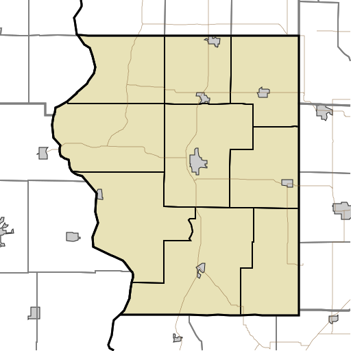
English: This is a map of the townships in Sullivan County, Indiana, USA. |
| ದಿನಾಂಕ | (UTC) |
| ಆಕರ | |
| ಕರ್ತೃ |
|
I, the copyright holder of this work, hereby publish it under the following license:
| I, the copyright holder of this work, release this work into the public domain. This applies worldwide. In some countries this may not be legally possible; if so: I grant anyone the right to use this work for any purpose, without any conditions, unless such conditions are required by law. |
Original upload log
This image is a derivative work of the following images:
- File:Map_highlighting_Cass_Township,_Sullivan_County,_Indiana.svg licensed with PD-self
- 2007-11-24T20:01:54Z File Upload Bot (Omnedon) 512x512 (26387 Bytes) == Summary == {{Information |Description={{en|This is a map of Sullivan County, Indiana, USA which highlights the location of Cass Township.}} |Source=My own work, using freely-available TIGER data and custom-written MapScri
Uploaded with derivativeFX
ಕಡತದ ಇತಿಹಾಸ
ದಿನ/ಕಾಲ ಒತ್ತಿದರೆ ಆ ಸಮಯದಲ್ಲಿ ಈ ಕಡತದ ವಸ್ತುಸ್ಥಿತಿ ತೋರುತ್ತದೆ.
| ದಿನ/ಕಾಲ | ಕಿರುನೋಟ | ಆಯಾಮಗಳು | ಬಳಕೆದಾರ | ಟಿಪ್ಪಣಿ | |
|---|---|---|---|---|---|
| ಪ್ರಸಕ್ತ | ೨೩:೪೭, ೧೭ ಆಗಸ್ಟ್ ೨೦೧೦ | | ೫೧೨ × ೫೧೨ (೫೩ KB) | Sweet kate | {{Information |Description={{en|This is a map of the townships in Sullivan County, Indiana, USA.}} |Source=*File:Map_highlighting_Cass_Township,_Sullivan_County,_Indiana.svg |Date=2010-08-17 18:13 (UTC) |Author=*[[:File:Map_highlighting_Cass_Townshi |
ಕಡತ ಬಳಕೆ
ಈ ಕೆಳಗಿನ ಪುಟವು ಈ ಚಿತ್ರಕ್ಕೆ ಸಂಪರ್ಕ ಹೊಂದಿದೆ:
ಜಾಗತಿಕ ಕಡತ ಉಪಯೋಗ
ಈ ಕಡತವನ್ನು ಕೆಳಗಿನ ಬೇರೆ ವಿಕಿಗಳೂ ಉಪಯೋಗಿಸುತ್ತಿವೆ:
- ar.wikipedia.org ಮೇಲೆ ಬಳಕೆ
- azb.wikipedia.org ಮೇಲೆ ಬಳಕೆ
- ceb.wikipedia.org ಮೇಲೆ ಬಳಕೆ
- en.wikipedia.org ಮೇಲೆ ಬಳಕೆ
- Union Christian College, Merom
- Cass, Indiana
- Fairbanks, Indiana
- Graysville, Indiana
- Jackson Hill, Indiana
- New Lebanon, Indiana
- Paxton, Indiana
- Pleasantville, Indiana
- Riverton, Indiana
- Scott City, Indiana
- Sullivan County Airport
- Module:Location map/data/USA Indiana Sullivan County/doc
- Baldridge, Indiana
- Benefiel Corner, Indiana
- Bucktown, Indiana
- Dodds Bridge, Indiana
- Gambill, Indiana
- Glendora, Indiana
- Greenville, Sullivan County, Indiana
- Merom Station, Indiana
- Riverview, Indiana
- Scotchtown, Indiana
- Shiloh, Indiana
- Standard, Indiana
- Stringtown, Sullivan County, Indiana
- Wilfred, Indiana
- Baker, Indiana
- East Shelburn, Indiana
- Hawton, Indiana
- Jericho, Indiana
- Curryville, Sullivan County, Indiana
- Sullivan County Courthouse (Indiana)
- Sherman Building (Sullivan, Indiana)
- Shelburn station
- Massacre, Indiana
- Caledonia, Indiana
- Farnsworth, Indiana
- Module:Location map/data/USA Indiana Sullivan County
- fa.wikipedia.org ಮೇಲೆ ಬಳಕೆ
ಈ ಫೈಲ್ನ ಹೆಚ್ಚು ಜಾಗತಿಕ ಬಳಕೆಯನ್ನು ವೀಕ್ಷಿಸಿ.