ಚಿತ್ರ:Map highlighting Cass Township, Sullivan County, Indiana.svg

Size of this PNG preview of this SVG file: ೫೧೨ × ೫೧೨ ಪಿಕ್ಸೆಲ್ಗಳು. ಇತರ ರೆಸಲ್ಯೂಶನ್ಗಳು: ೨೪೦ × ೨೪೦ ಪಿಕ್ಸೆಲ್ಗಳು | ೪೮೦ × ೪೮೦ ಪಿಕ್ಸೆಲ್ಗಳು | ೭೬೮ × ೭೬೮ ಪಿಕ್ಸೆಲ್ಗಳು | ೧,೦೨೪ × ೧,೦೨೪ ಪಿಕ್ಸೆಲ್ಗಳು | ೨,೦೪೮ × ೨,೦೪೮ ಪಿಕ್ಸೆಲ್ಗಳು.
ಮೂಲ ಕಡತ (SVG ಫೈಲು, ಸುಮಾರಾಗಿ ೫೧೨ × ೫೧೨ ಚಿತ್ರಬಿಂದುಗಳು, ಫೈಲಿನ ಗಾತ್ರ: ೨೬ KB)
ಈ ಫೈಲು ವಿಕಿಮೀಡಿಯ ಕಾಮನ್ಸ್ನಲ್ಲಿ ಇರುವುದು. ಅಲ್ಲಿನ ವಿವರಣೆ ಪುಟವನ್ನೇ ಕೆಳಗೆ ತೋರಿಸಲಾಗಿದೆ. ಕಾಮನ್ಸ್ ಕೃತಿಸ್ವಾಮ್ಯತೆಯಿಂದ ಮುಕ್ತ ಫೈಲುಗಳ ಒಂದು ಆಗರ. ಅಲ್ಲಿ ನೀವೂ ಸಹಕರಿಸಬಹುದು. |
ಸಾರಾಂಶ
| ವಿವರ |
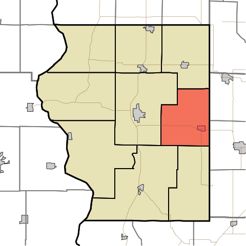
English: This is a map of Sullivan County, Indiana, USA which highlights the location of Cass Township. |
| ದಿನಾಂಕ | |
| ಆಕರ | My own work, using freely-available TIGER data and custom-written MapScript applications |
| ಕರ್ತೃ | Omnedon |
| ಇತರೆ ಆವೃತ್ತಿಗಳು | Derivative works of this file: Map of Sullivan County Indiana Townships.svg |
ಪರವಾನಗಿ
| I, the copyright holder of this work, release this work into the public domain. This applies worldwide. In some countries this may not be legally possible; if so: I grant anyone the right to use this work for any purpose, without any conditions, unless such conditions are required by law. |
ಕಡತದ ಇತಿಹಾಸ
ದಿನ/ಕಾಲ ಒತ್ತಿದರೆ ಆ ಸಮಯದಲ್ಲಿ ಈ ಕಡತದ ವಸ್ತುಸ್ಥಿತಿ ತೋರುತ್ತದೆ.
| ದಿನ/ಕಾಲ | ಕಿರುನೋಟ | ಆಯಾಮಗಳು | ಬಳಕೆದಾರ | ಟಿಪ್ಪಣಿ | |
|---|---|---|---|---|---|
| ಪ್ರಸಕ್ತ | ೦೧:೩೧, ೨೫ ನವೆಂಬರ್ ೨೦೦೭ | | ೫೧೨ × ೫೧೨ (೨೬ KB) | File Upload Bot (Omnedon) | == Summary == {{Information |Description={{en|This is a map of Sullivan County, Indiana, USA which highlights the location of Cass Township.}} |Source=My own work, using freely-available TIGER data and custom-written MapScript applications |Date=2007-11- |
ಕಡತ ಬಳಕೆ
ಈ ಫೈಲನ್ನು ಬಳಸುವ ಯಾವ ಪುಟಗಳೂ ಇಲ್ಲ.
ಜಾಗತಿಕ ಕಡತ ಉಪಯೋಗ
ಈ ಕಡತವನ್ನು ಕೆಳಗಿನ ಬೇರೆ ವಿಕಿಗಳೂ ಉಪಯೋಗಿಸುತ್ತಿವೆ:
- en.wikipedia.org ಮೇಲೆ ಬಳಕೆ
- eu.wikipedia.org ಮೇಲೆ ಬಳಕೆ
- ur.wikipedia.org ಮೇಲೆ ಬಳಕೆ
- vi.wikipedia.org ಮೇಲೆ ಬಳಕೆ
- www.wikidata.org ಮೇಲೆ ಬಳಕೆ
- zh.wikipedia.org ಮೇಲೆ ಬಳಕೆ