ಚಿತ್ರ:Location map of Middlesex County, New Jersey.svg

Size of this PNG preview of this SVG file: ೭೦೦ × ೬೦೦ ಪಿಕ್ಸೆಲ್ಗಳು. ಇತರ ರೆಸಲ್ಯೂಶನ್ಗಳು: ೨೮೦ × ೨೪೦ ಪಿಕ್ಸೆಲ್ಗಳು | ೫೬೦ × ೪೮೦ ಪಿಕ್ಸೆಲ್ಗಳು | ೮೯೬ × ೭೬೮ ಪಿಕ್ಸೆಲ್ಗಳು | ೧,೧೯೫ × ೧,೦೨೪ ಪಿಕ್ಸೆಲ್ಗಳು | ೨,೩೮೯ × ೨,೦೪೮ ಪಿಕ್ಸೆಲ್ಗಳು.
ಮೂಲ ಕಡತ (SVG ಫೈಲು, ಸುಮಾರಾಗಿ ೮೯೬ × ೭೬೮ ಚಿತ್ರಬಿಂದುಗಳು, ಫೈಲಿನ ಗಾತ್ರ: ೮೭೮ KB)
ಈ ಫೈಲು ವಿಕಿಮೀಡಿಯ ಕಾಮನ್ಸ್ನಲ್ಲಿ ಇರುವುದು. ಅಲ್ಲಿನ ವಿವರಣೆ ಪುಟವನ್ನೇ ಕೆಳಗೆ ತೋರಿಸಲಾಗಿದೆ. ಕಾಮನ್ಸ್ ಕೃತಿಸ್ವಾಮ್ಯತೆಯಿಂದ ಮುಕ್ತ ಫೈಲುಗಳ ಒಂದು ಆಗರ. ಅಲ್ಲಿ ನೀವೂ ಸಹಕರಿಸಬಹುದು. |
ಸಾರಾಂಶ
| ವಿವರ |
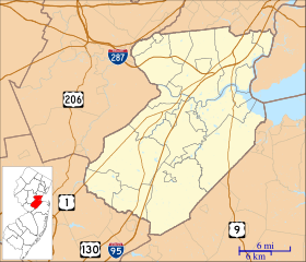
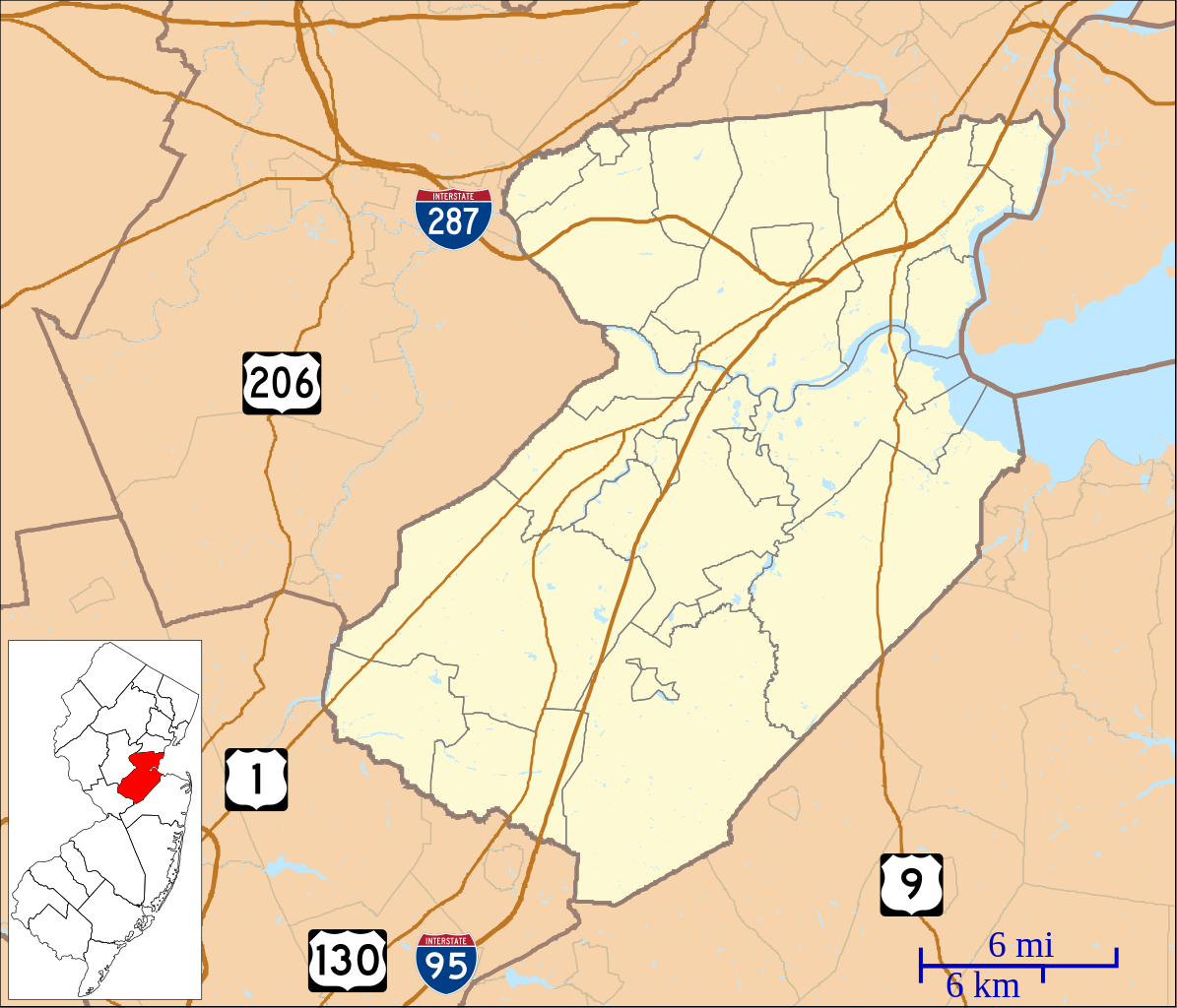
English: This is a map of Middlesex County, New Jersey, USA which includes incorporated settlements, township borders, and major highways. |
| ದಿನಾಂಕ | |
| ಆಕರ | My own work, using custom-written MapScript applications with United States Census Bureau data |
| ಕರ್ತೃ | Omnedon |
ಪರವಾನಗಿ
| I, the copyright holder of this work, release this work into the public domain. This applies worldwide. In some countries this may not be legally possible; if so: I grant anyone the right to use this work for any purpose, without any conditions, unless such conditions are required by law. |
ಕಡತದ ಇತಿಹಾಸ
ದಿನ/ಕಾಲ ಒತ್ತಿದರೆ ಆ ಸಮಯದಲ್ಲಿ ಈ ಕಡತದ ವಸ್ತುಸ್ಥಿತಿ ತೋರುತ್ತದೆ.
| ದಿನ/ಕಾಲ | ಕಿರುನೋಟ | ಆಯಾಮಗಳು | ಬಳಕೆದಾರ | ಟಿಪ್ಪಣಿ | |
|---|---|---|---|---|---|
| ಪ್ರಸಕ್ತ | ೧೧:೩೬, ೬ ಜೂನ್ ೨೦೨೩ | | ೮೯೬ × ೭೬೮ (೮೭೮ KB) | X5163x | Merged Princeton Township and Borough (was merged since 2013) |
| ೦೯:೨೪, ೨೭ ಸೆಪ್ಟೆಂಬರ್ ೨೦೧೨ |  | ೮೯೬ × ೭೬೮ (೮೮೦ KB) | Omnedon | == {{int:filedesc}} == {{Information |Description={{en|This is a map of Middlesex County, New Jersey, USA which includes incorporated settlements, township borders, and major highways.}} |Source=My own work, using cu... |
ಕಡತ ಬಳಕೆ
ಈ ಕೆಳಗಿನ ಪುಟವು ಈ ಚಿತ್ರಕ್ಕೆ ಸಂಪರ್ಕ ಹೊಂದಿದೆ:
ಜಾಗತಿಕ ಕಡತ ಉಪಯೋಗ
ಈ ಕಡತವನ್ನು ಕೆಳಗಿನ ಬೇರೆ ವಿಕಿಗಳೂ ಉಪಯೋಗಿಸುತ್ತಿವೆ:
- ar.wikipedia.org ಮೇಲೆ ಬಳಕೆ
- azb.wikipedia.org ಮೇಲೆ ಬಳಕೆ
- منلو پارک، نیوجرسی
- فینکس، ادیسون، نیوجرسی
- دینز، نیوجرسی
- سیریویل جانکشن، نیوجرسی
- منلو پارک تریس، نیوجرسی
- پارلین، نیوجرسی
- هوپلاون، نیوجرسی
- کیزبی، نیوجرسی
- کرانبوری، نیوجرسی
- نیو دوور، نیوجرسی
- نیوتوون، نیوجرسی
- آپلقارت، نیوجرسی
- دونالن، نیوجرسی
- ادیسون، نیوجرسی
- تراسی، نیوجرسی
- پرت آمبوی، نیوجرسی
- کارترت، نیوجرسی
- هئیزلتون، نیوجرسی
- هلمتا، نیوجرسی
- سایر وودز، نیوجرسی
- سایرویل، نیوجرسی
- جیمزبورق، نیوجرسی
- سوت آمبوی، نیوجرسی
- ایستلتون، نیوجرسی
- ceb.wikipedia.org ಮೇಲೆ ಬಳಕೆ
- en.wikipedia.org ಮೇಲೆ ಬಳಕೆ
- Avenel, New Jersey
- Brownville, New Jersey
- Carteret, New Jersey
- Colonia, New Jersey
- Concordia, New Jersey
- Cranbury (CDP), New Jersey
- Cranbury, New Jersey
- Dayton, New Jersey
- Dunellen, New Jersey
- East Brunswick, New Jersey
- Edison, New Jersey
- Fords, New Jersey
- Heathcote, New Jersey
- Helmetta, New Jersey
- Highland Park, New Jersey
- Iselin, New Jersey
- Jamesburg, New Jersey
- Kendall Park, New Jersey
- Kingston, New Jersey
- Laurence Harbor, New Jersey
- Madison Park, New Jersey
- Metuchen, New Jersey
- Middlesex, New Jersey
- Milltown, New Jersey
ಈ ಫೈಲ್ನ ಹೆಚ್ಚು ಜಾಗತಿಕ ಬಳಕೆಯನ್ನು ವೀಕ್ಷಿಸಿ.