ಚಿತ್ರ:Location map of Hunterdon County, New Jersey.svg

Size of this PNG preview of this SVG file: ೭೦೦ × ೬೦೦ ಪಿಕ್ಸೆಲ್ಗಳು. ಇತರ ರೆಸಲ್ಯೂಶನ್ಗಳು: ೨೮೦ × ೨೪೦ ಪಿಕ್ಸೆಲ್ಗಳು | ೫೬೦ × ೪೮೦ ಪಿಕ್ಸೆಲ್ಗಳು | ೮೯೬ × ೭೬೮ ಪಿಕ್ಸೆಲ್ಗಳು | ೧,೧೯೫ × ೧,೦೨೪ ಪಿಕ್ಸೆಲ್ಗಳು | ೨,೩೮೯ × ೨,೦೪೮ ಪಿಕ್ಸೆಲ್ಗಳು.
ಮೂಲ ಕಡತ (SVG ಫೈಲು, ಸುಮಾರಾಗಿ ೮೯೬ × ೭೬೮ ಚಿತ್ರಬಿಂದುಗಳು, ಫೈಲಿನ ಗಾತ್ರ: ೪೦೯ KB)
ಈ ಫೈಲು ವಿಕಿಮೀಡಿಯ ಕಾಮನ್ಸ್ನಲ್ಲಿ ಇರುವುದು. ಅಲ್ಲಿನ ವಿವರಣೆ ಪುಟವನ್ನೇ ಕೆಳಗೆ ತೋರಿಸಲಾಗಿದೆ. ಕಾಮನ್ಸ್ ಕೃತಿಸ್ವಾಮ್ಯತೆಯಿಂದ ಮುಕ್ತ ಫೈಲುಗಳ ಒಂದು ಆಗರ. ಅಲ್ಲಿ ನೀವೂ ಸಹಕರಿಸಬಹುದು. |
ಸಾರಾಂಶ
| ವಿವರ |
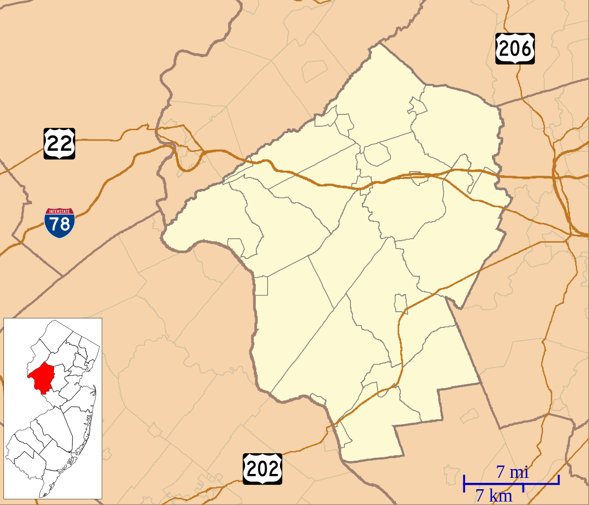
English: This is a map of Hunterdon County, New Jersey, USA which includes incorporated settlements, township borders, and major highways. |
| ದಿನಾಂಕ | |
| ಆಕರ | My own work, using custom-written MapScript applications with United States Census Bureau data |
| ಕರ್ತೃ | Omnedon |
ಪರವಾನಗಿ
| I, the copyright holder of this work, release this work into the public domain. This applies worldwide. In some countries this may not be legally possible; if so: I grant anyone the right to use this work for any purpose, without any conditions, unless such conditions are required by law. |
ಕಡತದ ಇತಿಹಾಸ
ದಿನ/ಕಾಲ ಒತ್ತಿದರೆ ಆ ಸಮಯದಲ್ಲಿ ಈ ಕಡತದ ವಸ್ತುಸ್ಥಿತಿ ತೋರುತ್ತದೆ.
| ದಿನ/ಕಾಲ | ಕಿರುನೋಟ | ಆಯಾಮಗಳು | ಬಳಕೆದಾರ | ಟಿಪ್ಪಣಿ | |
|---|---|---|---|---|---|
| ಪ್ರಸಕ್ತ | ೨೨:೩೬, ೭ ಜೂನ್ ೨೦೨೩ | | ೮೯೬ × ೭೬೮ (೪೦೯ KB) | X5163x | Updated map to reflect the merger of Princeton Township and Borough in 2012 |
| ೦೮:೪೯, ೩೦ ಸೆಪ್ಟೆಂಬರ್ ೨೦೧೨ |  | ೮೯೬ × ೭೬೮ (೪೧೦ KB) | Omnedon | == {{int:filedesc}} == {{Information |Description={{en|This is a map of Hunterdon County, New Jersey, USA which includes incorporated settlements, township borders, and major highways.}} |Source=My own work, using cu... |
ಕಡತ ಬಳಕೆ
ಈ ಕೆಳಗಿನ ಪುಟವು ಈ ಚಿತ್ರಕ್ಕೆ ಸಂಪರ್ಕ ಹೊಂದಿದೆ:
ಜಾಗತಿಕ ಕಡತ ಉಪಯೋಗ
ಈ ಕಡತವನ್ನು ಕೆಳಗಿನ ಬೇರೆ ವಿಕಿಗಳೂ ಉಪಯೋಗಿಸುತ್ತಿವೆ:
- ar.wikipedia.org ಮೇಲೆ ಬಳಕೆ
- azb.wikipedia.org ಮೇಲೆ ಬಳಕೆ
- پترزویل، نیوجرسی
- اولدویک، نیوجرسی
- سوینزبورق، نیوجرسی
- نیو هامپتون، نیوجرسی
- نورتون، نیوجرسی
- آمزتردام، نیوجرسی
- ورتسویل، نیوجرسی
- پیتستوون، نیوجرسی
- یونیونویل، نیوجرسی
- بلومزبوری، نیوجرسی
- والئی، نیوجرسی
- وان سیکل، نیوجرسی
- ورنوی، نیوجرسی
- بیرام، نیوجرسی
- کالیفون، نیوجرسی
- هیق بریدج، نیوجرسی
- وودقلن، نیوجرسی
- ایسپروس رون، نیوجرسی
- سنیدرتوون، نیوجرسی
- ایستانتون، نیوجرسی
- ایستوکتون، نیوجرسی
- ایستون میل، نیوجرسی
- ceb.wikipedia.org ಮೇಲೆ ಬಳಕೆ
- en.wikipedia.org ಮೇಲೆ ಬಳಕೆ
- Alexandria Township, New Jersey
- Annandale, New Jersey
- Bethlehem Township, New Jersey
- Bloomsbury, New Jersey
- Califon, New Jersey
- Clinton, New Jersey
- Clinton Township, New Jersey
- Delaware Township, Hunterdon County, New Jersey
- East Amwell Township, New Jersey
- Flemington, New Jersey
- Franklin Township, Hunterdon County, New Jersey
- Frenchtown, New Jersey
- Glen Gardner, New Jersey
- Hampton, New Jersey
- High Bridge, New Jersey
- Holland Township, New Jersey
- Kingwood Township, New Jersey
- Lambertville, New Jersey
- Lebanon, New Jersey
- Lebanon Township, New Jersey
- Milford, New Jersey
- Raritan Township, New Jersey
- Readington Township, New Jersey
- Stockton, New Jersey
- Tewksbury Township, New Jersey
- Union Township, Hunterdon County, New Jersey
ಈ ಫೈಲ್ನ ಹೆಚ್ಚು ಜಾಗತಿಕ ಬಳಕೆಯನ್ನು ವೀಕ್ಷಿಸಿ.