ಚಿತ್ರ:Inverness UK location map.svg

Size of this PNG preview of this SVG file: ೭೬೨ × ೬೦೦ ಪಿಕ್ಸೆಲ್ಗಳು. ಇತರ ರೆಸಲ್ಯೂಶನ್ಗಳು: ೩೦೫ × ೨೪೦ ಪಿಕ್ಸೆಲ್ಗಳು | ೬೧೦ × ೪೮೦ ಪಿಕ್ಸೆಲ್ಗಳು | ೯೭೬ × ೭೬೮ ಪಿಕ್ಸೆಲ್ಗಳು | ೧,೨೮೦ × ೧,೦೦೮ ಪಿಕ್ಸೆಲ್ಗಳು | ೨,೫೬೦ × ೨,೦೧೬ ಪಿಕ್ಸೆಲ್ಗಳು | ೧,೪೨೫ × ೧,೧೨೨ ಪಿಕ್ಸೆಲ್ಗಳು.
ಮೂಲ ಕಡತ (SVG ಫೈಲು, ಸುಮಾರಾಗಿ ೧,೪೨೫ × ೧,೧೨೨ ಚಿತ್ರಬಿಂದುಗಳು, ಫೈಲಿನ ಗಾತ್ರ: ೧.೫೯ MB)
ಈ ಫೈಲು ವಿಕಿಮೀಡಿಯ ಕಾಮನ್ಸ್ನಲ್ಲಿ ಇರುವುದು. ಅಲ್ಲಿನ ವಿವರಣೆ ಪುಟವನ್ನೇ ಕೆಳಗೆ ತೋರಿಸಲಾಗಿದೆ. ಕಾಮನ್ಸ್ ಕೃತಿಸ್ವಾಮ್ಯತೆಯಿಂದ ಮುಕ್ತ ಫೈಲುಗಳ ಒಂದು ಆಗರ. ಅಲ್ಲಿ ನೀವೂ ಸಹಕರಿಸಬಹುದು. |
| ವಿವರ |
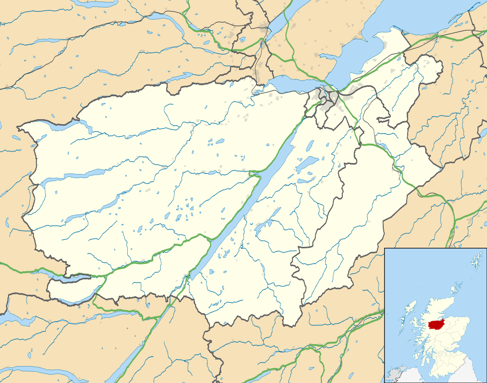
Map of the Inverness city management area, UK in 2011, with the following information shown:
Equirectangular map projection on WGS 84 datum, with N/S stretched 180% Geographic limits:
|
| ದಿನಾಂಕ | |
| ಆಕರ |
|
| ಕರ್ತೃ | Nilfanion, created using Ordnance Survey data |
| ಅನುಮತಿ (ಈ ಕಡತವನ್ನು ಮರುಬಳಕೆ ಮಾಡಲಾಗುತ್ತಿದೆ) |
ಈ ಕಡತ ಕ್ರಿಯೇಟಿವ್ ಕಾಮನ್ಸ್ Attribution
-Share Alike 3.0 Unported ಪರವಾನಗಿ ಹೊಂದಿದೆ. ವೈಶಿಷ್ಟ್ಯ: Contains Ordnance Survey data © Crown copyright and database right
|
| ಇತರೆ ಆವೃತ್ತಿಗಳು | File:Inverness UK blank map.svg - Blank map |
ಕಡತದ ಇತಿಹಾಸ
ದಿನ/ಕಾಲ ಒತ್ತಿದರೆ ಆ ಸಮಯದಲ್ಲಿ ಈ ಕಡತದ ವಸ್ತುಸ್ಥಿತಿ ತೋರುತ್ತದೆ.
| ದಿನ/ಕಾಲ | ಕಿರುನೋಟ | ಆಯಾಮಗಳು | ಬಳಕೆದಾರ | ಟಿಪ್ಪಣಿ | |
|---|---|---|---|---|---|
| ಪ್ರಸಕ್ತ | ೦೬:೩೯, ೨೨ ಫೆಬ್ರವರಿ ೨೦೧೧ | | ೧,೪೨೫ × ೧,೧೨೨ (೧.೫೯ MB) | Nilfanion | {{Information |Description=Map of the Inverness city management area, UK in 2011, with the following information shown: *Ward boundaries *Coastline and lakes *Roads and railways *Urban areas Equirectangular map projection on WGS 84 datum, |
ಕಡತ ಬಳಕೆ
ಈ ಕೆಳಗಿನ ಪುಟವು ಈ ಚಿತ್ರಕ್ಕೆ ಸಂಪರ್ಕ ಹೊಂದಿದೆ:
ಜಾಗತಿಕ ಕಡತ ಉಪಯೋಗ
ಈ ಕಡತವನ್ನು ಕೆಳಗಿನ ಬೇರೆ ವಿಕಿಗಳೂ ಉಪಯೋಗಿಸುತ್ತಿವೆ:
- ar.wikipedia.org ಮೇಲೆ ಬಳಕೆ
- ceb.wikipedia.org ಮೇಲೆ ಬಳಕೆ
- en.wikipedia.org ಮೇಲೆ ಬಳಕೆ
- Fort Augustus
- Fort George, Highland
- Culloden, Highland
- Urquhart Castle
- Invermoriston
- Caledonian Stadium
- Drumnadrochit
- Merkinch
- Raigmore Hospital
- Cawdor
- Aberarder
- Abriachan
- Achnaconeran
- South Kessock
- Beauly
- Millburn, Inverness
- Smithton, Highland
- Westhill, Highland
- Balloch, Highland
- Tomatin
- Cannich
- Cabrich
- Scorguie
- Tornagrain
- Balnain
- Ardendrain
- Ardnagrask
- Croy, Highland
- Talk:Smithton, Highland
- Kiltarlity
- Dores, Highland
- Moy, Highland
- Achnabat
- Allanfearn
- Aigas
- Aldourie
- Bunloit
- Foyers, Highland
- Balbeg, Highland
- Bunchrew
- Barnyards, Highland
- Gorthleck
- Crask of Aigas
- Leachkin
- Inverfarigaig
- Camault Muir
- Corrimony
- Wester Aberchalder
ಈ ಫೈಲ್ನ ಹೆಚ್ಚು ಜಾಗತಿಕ ಬಳಕೆಯನ್ನು ವೀಕ್ಷಿಸಿ.