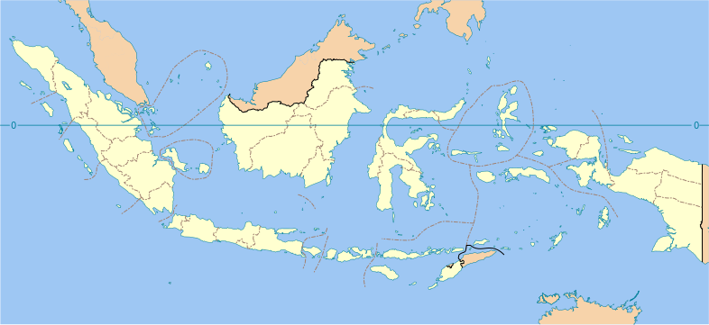
ಚಿತ್ರ:Indonesia provinces blank map.svg

Size of this PNG preview of this SVG file: ೭೮೬ × ೩೬೧ ಪಿಕ್ಸೆಲ್ಗಳು. ಇತರ ರೆಸಲ್ಯೂಶನ್ಗಳು: ೩೨೦ × ೧೪೭ ಪಿಕ್ಸೆಲ್ಗಳು | ೬೪೦ × ೨೯೪ ಪಿಕ್ಸೆಲ್ಗಳು | ೧,೦೨೪ × ೪೭೦ ಪಿಕ್ಸೆಲ್ಗಳು | ೧,೨೮೦ × ೫೮೮ ಪಿಕ್ಸೆಲ್ಗಳು | ೨,೫೬೦ × ೧,೧೭೬ ಪಿಕ್ಸೆಲ್ಗಳು.
ಮೂಲ ಕಡತ (SVG ಫೈಲು, ಸುಮಾರಾಗಿ ೭೮೬ × ೩೬೧ ಚಿತ್ರಬಿಂದುಗಳು, ಫೈಲಿನ ಗಾತ್ರ: ೮೫೩ KB)
ಕಡತದ ಇತಿಹಾಸ
ದಿನ/ಕಾಲ ಒತ್ತಿದರೆ ಆ ಸಮಯದಲ್ಲಿ ಈ ಕಡತದ ವಸ್ತುಸ್ಥಿತಿ ತೋರುತ್ತದೆ.
| ದಿನ/ಕಾಲ | ಕಿರುನೋಟ | ಆಯಾಮಗಳು | ಬಳಕೆದಾರ | ಟಿಪ್ಪಣಿ | |
|---|---|---|---|---|---|
| ಪ್ರಸಕ್ತ | ೨೨:೨೬, ೧೧ ಡಿಸೆಂಬರ್ ೨೦೨೨ |  | ೭೮೬ × ೩೬೧ (೮೫೩ KB) | NordNordWest | upd Papua |
| ೨೧:೧೦, ೨ ಜುಲೈ ೨೦೨೨ |  | ೭೮೬ × ೩೬೧ (೮೩೮ KB) | Bondguevara | Three recently formed Papuan provinces added | |
| ೦೧:೨೩, ೨೩ ಅಕ್ಟೋಬರ್ ೨೦೨೦ |  | ೭೮೬ × ೩೬೧ (೭೨೧ KB) | RXerself | Fix Menui as not Southeast Sulawesi; fix maritime borders traversing Marore Islands; fix lakes in East Kalimantan without ones in South Sulawesi; fix South-Southeast Sulawesi border; fix maritime borders traversing Liukang Tangaya; fix Banggai Laut-Taliabu border to hopefully cover Timpaus; fix Timor Leste as international border; I wouldn't add any maritime international/provincial borders if it were me since correct sources are scarce and a lot of islands got trampled over like this | |
| ೦೭:೨೬, ೧೭ ಅಕ್ಟೋಬರ್ ೨೦೨೦ |  | ೭೮೬ × ೩೬೧ (೭೧೪ KB) | Afrogindahood | Small addition of water borders | |
| ೦೩:೨೯, ೧೬ ಅಕ್ಟೋಬರ್ ೨೦೨೦ |  | ೭೮೬ × ೩೬೦ (೭೧೦ KB) | Afrogindahood | Fixes on some provincial water border errors, addition of coastline on Java | |
| ೦೦:೩೪, ೧೭ ಜುಲೈ ೨೦೨೦ |  | ೧,೩೨೨ × ೬೨೦ (೨೧೪ KB) | Delusion23 | Atauro is in Timor-Leste, not Indonesia | |
| ೧೬:೫೪, ೨೨ ಆಗಸ್ಟ್ ೨೦೧೩ |  | ೧,೩೨೨ × ೬೨೦ (೨೦೨ KB) | Gunkarta | Add border between East Kalimantan and North Kalimantan (new province formed on 25 October 2012, separated from East Kalimantan) | |
| ೧೬:೩೪, ೨೧ ಫೆಬ್ರವರಿ ೨೦೦೭ |  | ೧,೩೨೨ × ೬೨೦ (೩೮೯ KB) | Bwmodular | Added border between Bali and West Nusa Tenggara. Removed arrow from strait between Bali and Lombok. | |
| ೧೫:೫೪, ೭ ಫೆಬ್ರವರಿ ೨೦೦೭ |  | ೧,೩೨೨ × ೬೨೦ (೩೮೮ KB) | Bwmodular | Same as previous version, have just tidied up provincial boundaries so they don't poke out beyond coastal boundaries. | |
| ೨೨:೫೮, ೫ ಫೆಬ್ರವರಿ ೨೦೦೭ |  | ೧,೩೨೨ × ೬೨೦ (೩೮೮ KB) | Bwmodular | Identical to previous version, just tidying up some of the boundary lines so they don't spill into the ocean. |
ಕಡತ ಬಳಕೆ
ಈ ಕೆಳಗಿನ ಪುಟವು ಈ ಚಿತ್ರಕ್ಕೆ ಸಂಪರ್ಕ ಹೊಂದಿದೆ:
ಜಾಗತಿಕ ಕಡತ ಉಪಯೋಗ
ಈ ಕಡತವನ್ನು ಕೆಳಗಿನ ಬೇರೆ ವಿಕಿಗಳೂ ಉಪಯೋಗಿಸುತ್ತಿವೆ:
- ace.wikipedia.org ಮೇಲೆ ಬಳಕೆ
- af.wikipedia.org ಮೇಲೆ ಬಳಕೆ
- ar.wikipedia.org ಮೇಲೆ ಬಳಕೆ
- ban.wikipedia.org ಮೇಲೆ ಬಳಕೆ
- Propinsi ring Indonésia
- Mal:Indonésia/TOC
- Mal:Location map Indonésia (propinsi)
- Kecamatan miwah kelurahan ring Indonésia
- Kabupatén miwah kota ring Indonésia
- Gending daérah Indonésia
- Lis Tetamian Budaya Tenbenda Indonésia
- Perguruan tinggi negeri ring Indonésia
- Lis kode télépon ring Indonésia
- Rumah sakit ring Indonésia
- Lis tukad ring Indonésia
- Genah wisata ring Indonésia
- Lis nusa Indonésia
- Kabupatén miwah kota ring Indonésia manut galah pawentukannyané
- Lis wawidangan pemilihan propinsi Indonésia
- Mal:Peta Indonésia
- bbc.wikipedia.org ಮೇಲೆ ಬಳಕೆ
- bcl.wikipedia.org ಮೇಲೆ ಬಳಕೆ
- be.wikipedia.org ಮೇಲೆ ಬಳಕೆ
- bn.wikipedia.org ಮೇಲೆ ಬಳಕೆ
- bs.wikipedia.org ಮೇಲೆ ಬಳಕೆ
- ceb.wikipedia.org ಮೇಲೆ ಬಳಕೆ
- ckb.wikipedia.org ಮೇಲೆ ಬಳಕೆ
- crh.wikipedia.org ಮೇಲೆ ಬಳಕೆ
- da.wikipedia.org ಮೇಲೆ ಬಳಕೆ
- en.wikipedia.org ಮೇಲೆ ಬಳಕೆ
- Indonesia
- Provinces of Indonesia
- User:Bwmodular/Sandbox
- User:Imoeng/sandbox
- Template:Indonesia provinces labelled map
- Module:Location map/data/Indonesia provinces/doc
- User:Jonny-mt/Gallery of current first-level administrative country subdivisions maps
- Outline of Indonesia
- List of rivers of Indonesia
- List of Indonesian provinces by GRP per capita
- Wikipedia:Graphics Lab/Map workshop/Archive/Aug 2018
- Module:Location map/data/Indonesia provinces
- List of Indonesian provinces by GDP
- en.wikiversity.org ಮೇಲೆ ಬಳಕೆ
ಈ ಫೈಲ್ನ ಹೆಚ್ಚು ಜಾಗತಿಕ ಬಳಕೆಯನ್ನು ವೀಕ್ಷಿಸಿ.
