ಚಿತ್ರ:Golan location map 2.PNG

ಈ ಮುನ್ನೋಟ ಗಾತ್ರ:೭೫೯ × ೫೯೯ ಪಿಕ್ಸೆಲ್ಗಳು. ಇತರ ರೆಸಲ್ಯೂಶನ್ಗಳು: ೩೦೪ × ೨೪೦ ಪಿಕ್ಸೆಲ್ಗಳು | ೬೦೮ × ೪೮೦ ಪಿಕ್ಸೆಲ್ಗಳು | ೯೩೬ × ೭೩೯ ಪಿಕ್ಸೆಲ್ಗಳು.
ಮೂಲ ಕಡತ (೯೩೬ × ೭೩೯ ಚಿತ್ರಬಿಂದು, ಫೈಲಿನ ಗಾತ್ರ: ೧೪೦ KB, MIME ಪ್ರಕಾರ: image/png)
ಈ ಫೈಲು ವಿಕಿಮೀಡಿಯ ಕಾಮನ್ಸ್ನಲ್ಲಿ ಇರುವುದು. ಅಲ್ಲಿನ ವಿವರಣೆ ಪುಟವನ್ನೇ ಕೆಳಗೆ ತೋರಿಸಲಾಗಿದೆ. ಕಾಮನ್ಸ್ ಕೃತಿಸ್ವಾಮ್ಯತೆಯಿಂದ ಮುಕ್ತ ಫೈಲುಗಳ ಒಂದು ಆಗರ. ಅಲ್ಲಿ ನೀವೂ ಸಹಕರಿಸಬಹುದು. |
ಸಾರಾಂಶ
| ವಿವರ |
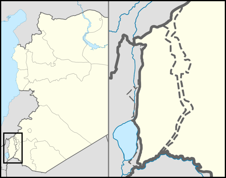
English: Location map of the Golan Heights. |
| ದಿನಾಂಕ | |
| ಆಕರ | |
| ಕರ್ತೃ | |
| ಅನುಮತಿ (ಈ ಕಡತವನ್ನು ಮರುಬಳಕೆ ಮಾಡಲಾಗುತ್ತಿದೆ) |
Creative Commons Attribution-Share Alike 3.0 Unported |
| ಇತರೆ ಆವೃತ್ತಿಗಳು | File:Golan location map 3.PNG |
ಪರವಾನಗಿ
This file is licensed under the Creative Commons Attribution 3.0 Unported license.
- ನೀವು ಮುಕ್ತ:
- ಹಂಚಿಕೆಗೆ – ಕೆಲಸವನ್ನು ನಕಲು ಮಾಡಲು, ವಿತರಣೆ ಮತ್ತು ಸಾಗಿಸಲು
- ರೀಮಿಕ್ಸ್ ಮಾಡಲು – ಕೆಲಸವನ್ನು ಬಳಸಿಕೊಳ್ಳಲು
- ಈ ಕೆಳಗಿನ ಷರತ್ತುಗಳಲ್ಲಿ:
- ವೈಶಿಷ್ಟ್ಯ – ನೀವು ಸೂಕ್ತವಾದ ಕ್ರೆಡಿಟ್ ನೀಡಬೇಕು, ಪರವಾನಗಿಗೆ ಲಿಂಕ್ ಅನ್ನು ಒದಗಿಸಬೇಕು ಮತ್ತು ಯಾವುದೇ ಬದಲಾವಣೆಗಳನ್ನು ಮಾಡಿದ್ದರೆ ಸೂಚಿಸಬೇಕು. ನೀವು ಯಾವುದೇ ಸಮಂಜಸವಾದ ರೀತಿಯಲ್ಲಿ ಮಾಡಬಹುದು, ಆದರೆ ಪರವಾನಗಿದಾರರು ನಿಮ್ಮನ್ನು ಅಥವಾ ನಿಮ್ಮ ಯಾವುದೇ ಬಳಕೆಯನ್ನು ಅನುಮೋದಿಸಿದಂತೆ ರೀತಿಯಲ್ಲಿ ಉಪಯೋಗಿಸಬಾರದು.
ಕಡತದ ಇತಿಹಾಸ
ದಿನ/ಕಾಲ ಒತ್ತಿದರೆ ಆ ಸಮಯದಲ್ಲಿ ಈ ಕಡತದ ವಸ್ತುಸ್ಥಿತಿ ತೋರುತ್ತದೆ.
| ದಿನ/ಕಾಲ | ಕಿರುನೋಟ | ಆಯಾಮಗಳು | ಬಳಕೆದಾರ | ಟಿಪ್ಪಣಿ | |
|---|---|---|---|---|---|
| ಪ್ರಸಕ್ತ | ೦೪:೩೭, ೩೧ ಅಕ್ಟೋಬರ್ ೨೦೧೨ | | ೯೩೬ × ೭೩೯ (೧೪೦ KB) | LtPowers | Reverted to version as of 21:06, 10 November 2011 |
| ೦೦:೪೯, ೩೧ ಅಕ್ಟೋಬರ್ ೨೦೧೨ |  | ೯೨೫ × ೭೩೯ (೧೪೬ KB) | HonorTheKing | Reverted to version as of 19:37, 10 November 2011 | |
| ೦೨:೩೬, ೧೧ ನವೆಂಬರ್ ೨೦೧೧ |  | ೯೩೬ × ೭೩೯ (೧೪೦ KB) | LtPowers | Reverted to version as of 18:51, 10 November 2011 | |
| ೦೧:೦೭, ೧೧ ನವೆಂಬರ್ ೨೦೧೧ |  | ೯೨೫ × ೭೩೯ (೧೪೬ KB) | Jiujitsuguy | Please see talk. Attempt to improve to NPOV showing territory belonging to neither side | |
| ೦೦:೨೧, ೧೧ ನವೆಂಬರ್ ೨೦೧೧ |  | ೯೩೬ × ೭೩೯ (೧೪೦ KB) | Nableezy | restore | |
| ೨೩:೩೭, ೧೦ ನವೆಂಬರ್ ೨೦೧೧ |  | ೯೨೫ × ೭೩೯ (೧೪೬ KB) | Chesdovi | "a disputed territory may not be presented in a way that supports one of the sides to the conflict" | |
| ೨೨:೩೦, ೧೦ ನವೆಂಬರ್ ೨೦೧೧ |  | ೯೩೬ × ೭೩೯ (೧೪೦ KB) | Nableezy | restore | |
| ೧೬:೦೬, ೧೦ ನವೆಂಬರ್ ೨೦೧೧ |  | ೯೨೫ × ೭೩೯ (೧೪೬ KB) | Biosketch | The image is displayed throughout Wikipedia and should be used to force a POV.. | |
| ೦೯:೪೭, ೧೦ ನವೆಂಬರ್ ೨೦೧೧ |  | ೯೩೬ × ೭೩೯ (೧೪೦ KB) | Supreme Deliciousness | Restore neutral map. | |
| ೦೯:೦೩, ೧೦ ನವೆಂಬರ್ ೨೦೧೧ |  | ೯೨೫ × ೭೩೯ (೧೪೬ KB) | Jiujitsuguy | Consistent with NPOV showing Heights controlled by neither side |
ಕಡತ ಬಳಕೆ
ಈ ಕೆಳಗಿನ ಪುಟವು ಈ ಚಿತ್ರಕ್ಕೆ ಸಂಪರ್ಕ ಹೊಂದಿದೆ:
ಜಾಗತಿಕ ಕಡತ ಉಪಯೋಗ
ಈ ಕಡತವನ್ನು ಕೆಳಗಿನ ಬೇರೆ ವಿಕಿಗಳೂ ಉಪಯೋಗಿಸುತ್ತಿವೆ:
- ar.wikipedia.org ಮೇಲೆ ಬಳಕೆ
- arz.wikipedia.org ಮೇಲೆ ಬಳಕೆ
- ba.wikipedia.org ಮೇಲೆ ಬಳಕೆ
- ca.wikipedia.org ಮೇಲೆ ಬಳಕೆ
- ceb.wikipedia.org ಮೇಲೆ ಬಳಕೆ
- ckb.wikipedia.org ಮೇಲೆ ಬಳಕೆ
- da.wikipedia.org ಮೇಲೆ ಬಳಕೆ
- de.wikipedia.org ಮೇಲೆ ಬಳಕೆ
- en.wikipedia.org ಮೇಲೆ ಬಳಕೆ
- Mount Hermon
- Quneitra
- Bethsaida
- Gamla
- Banias
- Nimrod Castle
- Afik
- Odem
- Buq'ata
- El Rom
- Avnei Eitan
- Rujm el-Hiri
- Ghajar
- Nimrod, Golan Heights
- Neve Ativ
- Keshet, Golan Heights
- Talk:Gamla
- Geshur, Golan Heights
- Mas'ade
- Ramot, Golan Heights
- Yonatan, Golan Heights
- Kfar Haruv
- Mevo Hama
- Beer Ajam
- Alonei HaBashan
- Ani'am
- Bnei Yehuda, Golan Heights
- Givat Yoav
- Haspin
- Ortal, Golan Heights
- Metzar
- Merom Golan
- Natur (Israeli settlement)
- Ein Zivan
- Kanaf
- Ma'ale Gamla
- Neot Golan
- Nov, Golan Heights
ಈ ಫೈಲ್ನ ಹೆಚ್ಚು ಜಾಗತಿಕ ಬಳಕೆಯನ್ನು ವೀಕ್ಷಿಸಿ.