ಚಿತ್ರ:Europe relief laea location map.jpg

ಈ ಮುನ್ನೋಟ ಗಾತ್ರ:೭೦೧ × ೫೯೯ ಪಿಕ್ಸೆಲ್ಗಳು. ಇತರ ರೆಸಲ್ಯೂಶನ್ಗಳು: ೨೮೧ × ೨೪೦ ಪಿಕ್ಸೆಲ್ಗಳು | ೫೬೧ × ೪೮೦ ಪಿಕ್ಸೆಲ್ಗಳು | ೮೯೮ × ೭೬೮ ಪಿಕ್ಸೆಲ್ಗಳು | ೧,೧೯೮ × ೧,೦೨೪ ಪಿಕ್ಸೆಲ್ಗಳು | ೧,೫೮೦ × ೧,೩೫೧ ಪಿಕ್ಸೆಲ್ಗಳು.
ಮೂಲ ಕಡತ (೧,೫೮೦ × ೧,೩೫೧ ಚಿತ್ರಬಿಂದು, ಫೈಲಿನ ಗಾತ್ರ: ೧.೧ MB, MIME ಪ್ರಕಾರ: image/jpeg)
ಈ ಫೈಲು ವಿಕಿಮೀಡಿಯ ಕಾಮನ್ಸ್ನಲ್ಲಿ ಇರುವುದು. ಅಲ್ಲಿನ ವಿವರಣೆ ಪುಟವನ್ನೇ ಕೆಳಗೆ ತೋರಿಸಲಾಗಿದೆ. ಕಾಮನ್ಸ್ ಕೃತಿಸ್ವಾಮ್ಯತೆಯಿಂದ ಮುಕ್ತ ಫೈಲುಗಳ ಒಂದು ಆಗರ. ಅಲ್ಲಿ ನೀವೂ ಸಹಕರಿಸಬಹುದು. |
India
ಸಾರಾಂಶ
| ವಿವರ |
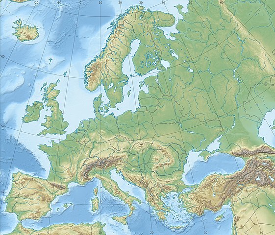
Deutsch: Physische Positionskarte Europa; Flächentreue Azimutalprojektion
English: Physical location map Europe; Lambert azimuthal equal-area projection
|
| ದಿನಾಂಕ | |
| ಆಕರ |
ಸ್ವಂತ ಕೆಲಸ
|
| ಕರ್ತೃ | Alexrk2 |
| ಇತರೆ ಆವೃತ್ತಿಗಳು |
Derivative works of this file:
[]
|


.svg)


_ru.svg)

|
This map has been made or improved in the German Kartenwerkstatt (Map Lab). You can propose maps to improve as well.
|
ಪರವಾನಗಿ
I, the copyright holder of this work, hereby publish it under the following license:
ಈ ಕಡತ ಕ್ರಿಯೇಟಿವ್ ಕಾಮನ್ಸ್ Attribution
-Share Alike 3.0 Unported ಪರವಾನಗಿ ಹೊಂದಿದೆ.
- ನೀವು ಮುಕ್ತ:
- ಹಂಚಿಕೆಗೆ – ಕೆಲಸವನ್ನು ನಕಲು ಮಾಡಲು, ವಿತರಣೆ ಮತ್ತು ಸಾಗಿಸಲು
- ರೀಮಿಕ್ಸ್ ಮಾಡಲು – ಕೆಲಸವನ್ನು ಬಳಸಿಕೊಳ್ಳಲು
- ಈ ಕೆಳಗಿನ ಷರತ್ತುಗಳಲ್ಲಿ:
- ವೈಶಿಷ್ಟ್ಯ – ನೀವು ಸೂಕ್ತವಾದ ಕ್ರೆಡಿಟ್ ನೀಡಬೇಕು, ಪರವಾನಗಿಗೆ ಲಿಂಕ್ ಅನ್ನು ಒದಗಿಸಬೇಕು ಮತ್ತು ಯಾವುದೇ ಬದಲಾವಣೆಗಳನ್ನು ಮಾಡಿದ್ದರೆ ಸೂಚಿಸಬೇಕು. ನೀವು ಯಾವುದೇ ಸಮಂಜಸವಾದ ರೀತಿಯಲ್ಲಿ ಮಾಡಬಹುದು, ಆದರೆ ಪರವಾನಗಿದಾರರು ನಿಮ್ಮನ್ನು ಅಥವಾ ನಿಮ್ಮ ಯಾವುದೇ ಬಳಕೆಯನ್ನು ಅನುಮೋದಿಸಿದಂತೆ ರೀತಿಯಲ್ಲಿ ಉಪಯೋಗಿಸಬಾರದು.
- ಇರುವುದರಂತೆಯೇ ಹಂಚು – ನೀವು ರೀಮಿಕ್ಸ್ ಮಾಡಿದರೆ, ರೂಪಾಂತರಗೊಳಿಸಿದರೆ ಅಥವಾ ವಸ್ತುವಿನ ಮೇಲೆ ನಿರ್ಮಿಸಿದರೆ, ನಿಮ್ಮ ಕೊಡುಗೆಗಳನ್ನು ನೀವು ಮೂಲದಂತೆ ಅದೇ ಅಥವಾ ಹೊಂದಾಣಿಕೆಯ ಪರವಾನಗಿ ಅಡಿಯಲ್ಲಿ ವಿತರಿಸಬೇಕು.
ಕಡತದ ಇತಿಹಾಸ
ದಿನ/ಕಾಲ ಒತ್ತಿದರೆ ಆ ಸಮಯದಲ್ಲಿ ಈ ಕಡತದ ವಸ್ತುಸ್ಥಿತಿ ತೋರುತ್ತದೆ.
| ದಿನ/ಕಾಲ | ಕಿರುನೋಟ | ಆಯಾಮಗಳು | ಬಳಕೆದಾರ | ಟಿಪ್ಪಣಿ | |
|---|---|---|---|---|---|
| ಪ್ರಸಕ್ತ | ೦೩:೫೯, ೫ ಜುಲೈ ೨೦೧೮ | | ೧,೫೮೦ × ೧,೩೫೧ (೧.೧ MB) | Subtropical-man | Reverted to version as of 22:56, 20 August 2012 (UTC) |
| ೨೩:೨೪, ೨ ಜುಲೈ ೨೦೧೮ |  | ೧,೫೮೦ × ೧,೩೫೧ (೮೨೧ KB) | 1970gemini | fiat lux | |
| ೦೪:೨೬, ೨೧ ಆಗಸ್ಟ್ ೨೦೧೨ |  | ೧,೫೮೦ × ೧,೩೫೧ (೧.೧ MB) | McZusatz | Reverted to version as of 10:53, 14 March 2010 (...thumb fixed?) | |
| ೦೪:೨೫, ೨೧ ಆಗಸ್ಟ್ ೨೦೧೨ |  | ೧೨೦ × ೧೦೩ (೪ KB) | McZusatz | fixing thumb... | |
| ೧೬:೨೩, ೧೪ ಮಾರ್ಚ್ ೨೦೧೦ |  | ೧,೫೮೦ × ೧,೩೫೧ (೧.೧ MB) | Alexrk2 | == Summary == {{Information |Description= {{de|Physische Positionskarte Europa; Flächentreue Azimutalprojektion}} {{en|Physical location map Europe; Lambert azimuthal equal-area projection}} * Projection: LAEA Europe, [http: |
ಕಡತ ಬಳಕೆ
ಈ ಕೆಳಗಿನ ಪುಟವು ಈ ಚಿತ್ರಕ್ಕೆ ಸಂಪರ್ಕ ಹೊಂದಿದೆ:
ಜಾಗತಿಕ ಕಡತ ಉಪಯೋಗ
ಈ ಕಡತವನ್ನು ಕೆಳಗಿನ ಬೇರೆ ವಿಕಿಗಳೂ ಉಪಯೋಗಿಸುತ್ತಿವೆ:
- ab.wikipedia.org ಮೇಲೆ ಬಳಕೆ
- als.wikipedia.org ಮೇಲೆ ಬಳಕೆ
- ar.wikipedia.org ಮೇಲೆ ಬಳಕೆ
- arz.wikipedia.org ಮೇಲೆ ಬಳಕೆ
- ast.wikipedia.org ಮೇಲೆ ಬಳಕೆ
- av.wikipedia.org ಮೇಲೆ ಬಳಕೆ
- azb.wikipedia.org ಮೇಲೆ ಬಳಕೆ
- az.wikipedia.org ಮೇಲೆ ಬಳಕೆ
ಈ ಫೈಲ್ನ ಹೆಚ್ಚು ಜಾಗತಿಕ ಬಳಕೆಯನ್ನು ವೀಕ್ಷಿಸಿ.