ಚಿತ್ರ:Buckinghamshire UK relief location map.jpg

ಈ ಮುನ್ನೋಟ ಗಾತ್ರ:೫೦೬ × ೫೯೯ ಪಿಕ್ಸೆಲ್ಗಳು. ಇತರ ರೆಸಲ್ಯೂಶನ್ಗಳು: ೨೦೩ × ೨೪೦ ಪಿಕ್ಸೆಲ್ಗಳು | ೪೦೫ × ೪೮೦ ಪಿಕ್ಸೆಲ್ಗಳು | ೬೪೯ × ೭೬೮ ಪಿಕ್ಸೆಲ್ಗಳು | ೮೬೫ × ೧,೦೨೪ ಪಿಕ್ಸೆಲ್ಗಳು | ೨,೦೦೫ × ೨,೩೭೪ ಪಿಕ್ಸೆಲ್ಗಳು.
ಮೂಲ ಕಡತ (೨,೦೦೫ × ೨,೩೭೪ ಚಿತ್ರಬಿಂದು, ಫೈಲಿನ ಗಾತ್ರ: ೪೬೫ KB, MIME ಪ್ರಕಾರ: image/jpeg)
ಈ ಫೈಲು ವಿಕಿಮೀಡಿಯ ಕಾಮನ್ಸ್ನಲ್ಲಿ ಇರುವುದು. ಅಲ್ಲಿನ ವಿವರಣೆ ಪುಟವನ್ನೇ ಕೆಳಗೆ ತೋರಿಸಲಾಗಿದೆ. ಕಾಮನ್ಸ್ ಕೃತಿಸ್ವಾಮ್ಯತೆಯಿಂದ ಮುಕ್ತ ಫೈಲುಗಳ ಒಂದು ಆಗರ. ಅಲ್ಲಿ ನೀವೂ ಸಹಕರಿಸಬಹುದು. |
| ವಿವರ |
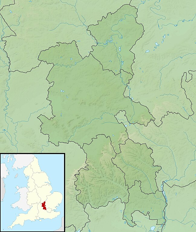
Relief map of Buckinghamshire, UK. Equirectangular map projection on WGS 84 datum, with N/S stretched 160% Geographic limits:
|
| ದಿನಾಂಕ | |
| ಆಕರ |
|
| ಕರ್ತೃ | Nilfanion, created using Ordnance Survey data |
| ಅನುಮತಿ (ಈ ಕಡತವನ್ನು ಮರುಬಳಕೆ ಮಾಡಲಾಗುತ್ತಿದೆ) |
ಈ ಕಡತ ಕ್ರಿಯೇಟಿವ್ ಕಾಮನ್ಸ್ Attribution
-Share Alike 3.0 Unported ಪರವಾನಗಿ ಹೊಂದಿದೆ. ವೈಶಿಷ್ಟ್ಯ: Contains Ordnance Survey data © Crown copyright and database right
|
| ಇತರೆ ಆವೃತ್ತಿಗಳು | File:Buckinghamshire UK district map (blank).svg - Blank map |
.svg)
ಕಡತದ ಇತಿಹಾಸ
ದಿನ/ಕಾಲ ಒತ್ತಿದರೆ ಆ ಸಮಯದಲ್ಲಿ ಈ ಕಡತದ ವಸ್ತುಸ್ಥಿತಿ ತೋರುತ್ತದೆ.
| ದಿನ/ಕಾಲ | ಕಿರುನೋಟ | ಆಯಾಮಗಳು | ಬಳಕೆದಾರ | ಟಿಪ್ಪಣಿ | |
|---|---|---|---|---|---|
| ಪ್ರಸಕ್ತ | ೦೬:೪೮, ೨೯ ನವೆಂಬರ್ ೨೦೧೧ | | ೨,೦೦೫ × ೨,೩೭೪ (೪೬೫ KB) | Nilfanion | {{Information |Description=Relief map of Buckinghamshire, UK. Equirectangular map projection on WGS 84 datum, with N/S stretched 160% Geographic limits: *West: 1.33W *East: 0.33W *North: 52.21N *South: 51.47N |Source=[[w:Ordnance S |
ಕಡತ ಬಳಕೆ
ಈ ಕೆಳಗಿನ ಪುಟವು ಈ ಚಿತ್ರಕ್ಕೆ ಸಂಪರ್ಕ ಹೊಂದಿದೆ:
ಜಾಗತಿಕ ಕಡತ ಉಪಯೋಗ
ಈ ಕಡತವನ್ನು ಕೆಳಗಿನ ಬೇರೆ ವಿಕಿಗಳೂ ಉಪಯೋಗಿಸುತ್ತಿವೆ:
- ar.wikipedia.org ಮೇಲೆ ಬಳಕೆ
- bg.wikipedia.org ಮೇಲೆ ಬಳಕೆ
- ceb.wikipedia.org ಮೇಲೆ ಬಳಕೆ
- en.wikipedia.org ಮೇಲೆ ಬಳಕೆ
- Ivinghoe Beacon
- Hughenden Manor
- Coombe Hill, Buckinghamshire
- Dorney Lake
- Haddington Hill
- Fawley Court
- Taplow Court
- The Heritage (European Tour)
- Travis Perkins Masters
- Dorton House, Buckinghamshire
- Wotton House
- Gayhurst House
- Battle of Olney Bridge
- Beaconsfield Golf Club
- Module:Location map/data/United Kingdom Buckinghamshire
- Module:Location map/data/Buckinghamshire
- Module:Location map/data/United Kingdom Buckinghamshire/doc
- Cerberus Privy
- fr.wikipedia.org ಮೇಲೆ ಬಳಕೆ
- hu.wikipedia.org ಮೇಲೆ ಬಳಕೆ
- it.wikipedia.org ಮೇಲೆ ಬಳಕೆ
- ja.wikipedia.org ಮೇಲೆ ಬಳಕೆ
- lv.wikipedia.org ಮೇಲೆ ಬಳಕೆ
- mk.wikipedia.org ಮೇಲೆ ಬಳಕೆ
- nl.wikipedia.org ಮೇಲೆ ಬಳಕೆ
- os.wikipedia.org ಮೇಲೆ ಬಳಕೆ
- pl.wikipedia.org ಮೇಲೆ ಬಳಕೆ
- pl.wikibooks.org ಮೇಲೆ ಬಳಕೆ
- sco.wikipedia.org ಮೇಲೆ ಬಳಕೆ
- simple.wikipedia.org ಮೇಲೆ ಬಳಕೆ
- si.wikipedia.org ಮೇಲೆ ಬಳಕೆ
ಈ ಫೈಲ್ನ ಹೆಚ್ಚು ಜಾಗತಿಕ ಬಳಕೆಯನ್ನು ವೀಕ್ಷಿಸಿ.