ಚಿತ್ರ:Buckinghamshire UK location map.svg

Size of this PNG preview of this SVG file: ೫೦೭ × ೬೦೦ ಪಿಕ್ಸೆಲ್ಗಳು. ಇತರ ರೆಸಲ್ಯೂಶನ್ಗಳು: ೨೦೩ × ೨೪೦ ಪಿಕ್ಸೆಲ್ಗಳು | ೪೦೬ × ೪೮೦ ಪಿಕ್ಸೆಲ್ಗಳು | ೬೪೯ × ೭೬೮ ಪಿಕ್ಸೆಲ್ಗಳು | ೮೬೫ × ೧,೦೨೪ ಪಿಕ್ಸೆಲ್ಗಳು | ೧,೭೩೧ × ೨,೦೪೮ ಪಿಕ್ಸೆಲ್ಗಳು | ೧,೦೭೦ × ೧,೨೬೬ ಪಿಕ್ಸೆಲ್ಗಳು.
ಮೂಲ ಕಡತ (SVG ಫೈಲು, ಸುಮಾರಾಗಿ ೧,೦೭೦ × ೧,೨೬೬ ಚಿತ್ರಬಿಂದುಗಳು, ಫೈಲಿನ ಗಾತ್ರ: ೨.೧೩ MB)
ಈ ಫೈಲು ವಿಕಿಮೀಡಿಯ ಕಾಮನ್ಸ್ನಲ್ಲಿ ಇರುವುದು. ಅಲ್ಲಿನ ವಿವರಣೆ ಪುಟವನ್ನೇ ಕೆಳಗೆ ತೋರಿಸಲಾಗಿದೆ. ಕಾಮನ್ಸ್ ಕೃತಿಸ್ವಾಮ್ಯತೆಯಿಂದ ಮುಕ್ತ ಫೈಲುಗಳ ಒಂದು ಆಗರ. ಅಲ್ಲಿ ನೀವೂ ಸಹಕರಿಸಬಹುದು. |
| ವಿವರ |
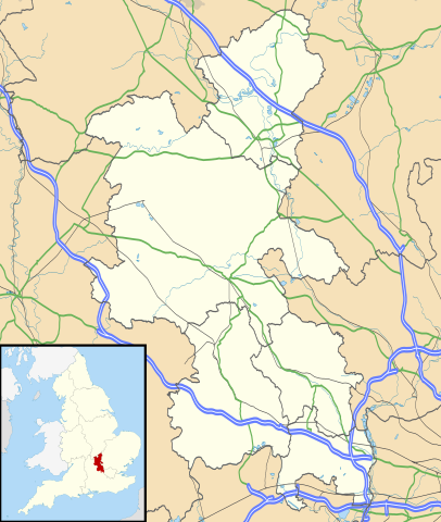
Map of Buckinghamshire, UK with the following information shown:
Equirectangular map projection on WGS 84 datum, with N/S stretched 160% Geographic limits:
|
| ದಿನಾಂಕ | |
| ಆಕರ |
|
| ಕರ್ತೃ | Nilfanion, created using Ordnance Survey data |
| ಅನುಮತಿ (ಈ ಕಡತವನ್ನು ಮರುಬಳಕೆ ಮಾಡಲಾಗುತ್ತಿದೆ) |
ಈ ಕಡತ ಕ್ರಿಯೇಟಿವ್ ಕಾಮನ್ಸ್ Attribution
-Share Alike 3.0 Unported ಪರವಾನಗಿ ಹೊಂದಿದೆ. ವೈಶಿಷ್ಟ್ಯ: Contains Ordnance Survey data © Crown copyright and database right
|
| ಇತರೆ ಆವೃತ್ತಿಗಳು | File:Buckinghamshire UK district map (blank).svg - Blank map |
.svg)
ಕಡತದ ಇತಿಹಾಸ
ದಿನ/ಕಾಲ ಒತ್ತಿದರೆ ಆ ಸಮಯದಲ್ಲಿ ಈ ಕಡತದ ವಸ್ತುಸ್ಥಿತಿ ತೋರುತ್ತದೆ.
| ದಿನ/ಕಾಲ | ಕಿರುನೋಟ | ಆಯಾಮಗಳು | ಬಳಕೆದಾರ | ಟಿಪ್ಪಣಿ | |
|---|---|---|---|---|---|
| ಪ್ರಸಕ್ತ | ೦೦:೧೧, ೨೭ ಸೆಪ್ಟೆಂಬರ್ ೨೦೧೦ | | ೧,೦೭೦ × ೧,೨೬೬ (೨.೧೩ MB) | Nilfanion | {{Information |Description=Map of Buckinghamshire, UK with the following information shown: *Administrative borders *Coastline, lakes and rivers *Roads and railways *Urban areas Equirectangular map projection on WGS 84 datum, with N |
ಕಡತ ಬಳಕೆ
ಈ ಕೆಳಗಿನ ಪುಟವು ಈ ಚಿತ್ರಕ್ಕೆ ಸಂಪರ್ಕ ಹೊಂದಿದೆ:
ಜಾಗತಿಕ ಕಡತ ಉಪಯೋಗ
ಈ ಕಡತವನ್ನು ಕೆಳಗಿನ ಬೇರೆ ವಿಕಿಗಳೂ ಉಪಯೋಗಿಸುತ್ತಿವೆ:
- ar.wikipedia.org ಮೇಲೆ ಬಳಕೆ
- bg.wikipedia.org ಮೇಲೆ ಬಳಕೆ
- ceb.wikipedia.org ಮೇಲೆ ಬಳಕೆ
- cs.wikipedia.org ಮೇಲೆ ಬಳಕೆ
- en.wikipedia.org ಮೇಲೆ ಬಳಕೆ
- Amersham
- Milton Keynes
- High Wycombe
- Aylesbury
- Buckingham
- Maids Moreton
- Southcourt
- West Wycombe
- Chesham
- Quarrendon
- Bedgrove
- Stoke Mandeville
- Great and Little Kimble cum Marsh
- Cheddington
- New Zealand, Buckinghamshire
- California, Buckinghamshire
- Aston Clinton
- Beaconsfield
- Bierton
- Wendover
- Broughton, Aylesbury
- Great and Little Hampden
- Winslow, Buckinghamshire
- Cliveden
- Amersham station
- RAF Halton
- Long Crendon
- Shabbington
- Addington, Buckinghamshire
- Adstock
- Monks Risborough
- Princes Risborough
- Calvert, Buckinghamshire
- Woughton (parish)
- Olney, Buckinghamshire
- Hughenden Valley
- Castlethorpe
- Watermead, Buckinghamshire
- Caldecote, Buckinghamshire
- Whiteleaf, Buckinghamshire
- Newport Pagnell
- Tylers Green
- Dorney
- Stowe, Buckinghamshire
ಈ ಫೈಲ್ನ ಹೆಚ್ಚು ಜಾಗತಿಕ ಬಳಕೆಯನ್ನು ವೀಕ್ಷಿಸಿ.