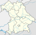
ಚಿತ್ರ:Bavaria location map.svg

Size of this PNG preview of this SVG file: ೬೦೮ × ೬೦೦ ಪಿಕ್ಸೆಲ್ಗಳು. ಇತರ ರೆಸಲ್ಯೂಶನ್ಗಳು: ೨೪೩ × ೨೪೦ ಪಿಕ್ಸೆಲ್ಗಳು | ೪೮೭ × ೪೮೦ ಪಿಕ್ಸೆಲ್ಗಳು | ೭೭೯ × ೭೬೮ ಪಿಕ್ಸೆಲ್ಗಳು | ೧,೦೩೮ × ೧,೦೨೪ ಪಿಕ್ಸೆಲ್ಗಳು | ೨,೦೭೭ × ೨,೦೪೮ ಪಿಕ್ಸೆಲ್ಗಳು | ೮೬೭ × ೮೫೫ ಪಿಕ್ಸೆಲ್ಗಳು.
ಮೂಲ ಕಡತ (SVG ಫೈಲು, ಸುಮಾರಾಗಿ ೮೬೭ × ೮೫೫ ಚಿತ್ರಬಿಂದುಗಳು, ಫೈಲಿನ ಗಾತ್ರ: ೭೩೮ KB)
ಕಡತದ ಇತಿಹಾಸ
ದಿನ/ಕಾಲ ಒತ್ತಿದರೆ ಆ ಸಮಯದಲ್ಲಿ ಈ ಕಡತದ ವಸ್ತುಸ್ಥಿತಿ ತೋರುತ್ತದೆ.
| ದಿನ/ಕಾಲ | ಕಿರುನೋಟ | ಆಯಾಮಗಳು | ಬಳಕೆದಾರ | ಟಿಪ್ಪಣಿ | |
|---|---|---|---|---|---|
| ಪ್ರಸಕ್ತ | ೨೨:೫೨, ೧೯ ನವೆಂಬರ್ ೨೦೦೯ |  | ೮೬೭ × ೮೫೫ (೭೩೮ KB) | Alexrk2 | fixed boundaries, rivers; adjusted map projection; colors for internal divisions |
| ೦೧:೩೧, ೨೯ ಮಾರ್ಚ್ ೨೦೦೯ |  | ೮೬೭ × ೮೫೫ (೧.೦೫ MB) | TUBS | #corrected 4 mistakes (lake margins (pasted to foreground), RegBez and counties around TIR (splited area in two counties and corrected RegBez border), County of Munich (merged), Merged an (to me right know unknown) county north of Nuremberg. #moved all gr | |
| ೧೫:೦೨, ೨೮ ಜನವರಿ ೨೦೦೯ |  | ೮೬೭ × ೮೫೫ (೧.೪೫ MB) | TUBS | {{Information |Description= |Source= |Date= |Author= |Permission= |other_versions= }} | |
| ೦೫:೫೦, ೨೮ ಜನವರಿ ೨೦೦೯ |  | ೮೬೭ × ೮೫೫ (೧.೪೫ MB) | TUBS | {{Information |Description= |Source= |Date= |Author= |Permission= |other_versions= }} | |
| ೦೫:೪೧, ೨೭ ಜನವರಿ ೨೦೦೯ |  | ೮೬೭ × ೮೫೫ (೧.೪೬ MB) | TUBS | {{Information |Description= |Source= |Date= |Author= |Permission= |other_versions= }} | |
| ೦೪:೫೦, ೨೭ ಜನವರಿ ೨೦೦೯ |  | ೮೬೭ × ೮೫೫ (೧.೫ MB) | TUBS | {{Information |Description= |Source= |Date= |Author= |Permission= |other_versions= }} | |
| ೧೭:೦೮, ೨೬ ಜನವರಿ ೨೦೦೯ |  | ೮೬೭ × ೮೫೫ (೧.೫೧ MB) | TUBS | == Summary == {{Information |Description= {{de|Positionskarte Hessen, Deutschland. Geographische Begrenzung der Karte:}} {{en|Location map Bavaria, Germany. Geographic limits of the map:}} * N: 50.6303000° N * S: 47.26618 | |
| ೧೬:೫೪, ೨೬ ಜನವರಿ ೨೦೦೯ |  | ೮೬೭ × ೮೫೫ (೧.೫೨ MB) | TUBS | == Summary == {{Information |Description= {{de|Positionskarte Hessen, Deutschland. Geographische Begrenzung der Karte:}} {{en|Location map Bavaria, Germany. Geographic limits of the map:}} * N: 50.6303000° N * S: 47.26618 |
ಕಡತ ಬಳಕೆ
ಈ ಕೆಳಗಿನ ಪುಟವು ಈ ಚಿತ್ರಕ್ಕೆ ಸಂಪರ್ಕ ಹೊಂದಿದೆ:
ಜಾಗತಿಕ ಕಡತ ಉಪಯೋಗ
ಈ ಕಡತವನ್ನು ಕೆಳಗಿನ ಬೇರೆ ವಿಕಿಗಳೂ ಉಪಯೋಗಿಸುತ್ತಿವೆ:
- af.wikipedia.org ಮೇಲೆ ಬಳಕೆ
- als.wikipedia.org ಮೇಲೆ ಬಳಕೆ
- ar.wikipedia.org ಮೇಲೆ ಬಳಕೆ
- ast.wikipedia.org ಮೇಲೆ ಬಳಕೆ
- azb.wikipedia.org ಮೇಲೆ ಬಳಕೆ
ಈ ಫೈಲ್ನ ಹೆಚ್ಚು ಜಾಗತಿಕ ಬಳಕೆಯನ್ನು ವೀಕ್ಷಿಸಿ.

