ಚಿತ್ರ:Australia Victoria Moira Shire location map.svg

Size of this PNG preview of this SVG file: ೫೩೫ × ೩೨೧ ಪಿಕ್ಸೆಲ್ಗಳು. ಇತರ ರೆಸಲ್ಯೂಶನ್ಗಳು: ೩೨೦ × ೧೯೨ ಪಿಕ್ಸೆಲ್ಗಳು | ೬೪೦ × ೩೮೪ ಪಿಕ್ಸೆಲ್ಗಳು | ೧,೦೨೪ × ೬೧೪ ಪಿಕ್ಸೆಲ್ಗಳು | ೧,೨೮೦ × ೭೬೮ ಪಿಕ್ಸೆಲ್ಗಳು | ೨,೫೬೦ × ೧,೫೩೬ ಪಿಕ್ಸೆಲ್ಗಳು.
ಮೂಲ ಕಡತ (SVG ಫೈಲು, ಸುಮಾರಾಗಿ ೫೩೫ × ೩೨೧ ಚಿತ್ರಬಿಂದುಗಳು, ಫೈಲಿನ ಗಾತ್ರ: ೫೪೦ KB)
ಈ ಫೈಲು ವಿಕಿಮೀಡಿಯ ಕಾಮನ್ಸ್ನಲ್ಲಿ ಇರುವುದು. ಅಲ್ಲಿನ ವಿವರಣೆ ಪುಟವನ್ನೇ ಕೆಳಗೆ ತೋರಿಸಲಾಗಿದೆ. ಕಾಮನ್ಸ್ ಕೃತಿಸ್ವಾಮ್ಯತೆಯಿಂದ ಮುಕ್ತ ಫೈಲುಗಳ ಒಂದು ಆಗರ. ಅಲ್ಲಿ ನೀವೂ ಸಹಕರಿಸಬಹುದು. |
| ವಿವರ |
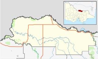
English: Blank map of w:Moira Shire, Victoria, Australia, with the following information shown:
Geographic limits:
|
||
| ಆಕರ | ಸ್ವಂತ ಕೆಲಸ + VicMap Lite | ||
| ಕರ್ತೃ | Cassowary |

ಕಡತದ ಇತಿಹಾಸ
ದಿನ/ಕಾಲ ಒತ್ತಿದರೆ ಆ ಸಮಯದಲ್ಲಿ ಈ ಕಡತದ ವಸ್ತುಸ್ಥಿತಿ ತೋರುತ್ತದೆ.
| ದಿನ/ಕಾಲ | ಕಿರುನೋಟ | ಆಯಾಮಗಳು | ಬಳಕೆದಾರ | ಟಿಪ್ಪಣಿ | |
|---|---|---|---|---|---|
| ಪ್ರಸಕ್ತ | ೨೩:೨೬, ೧೮ ಫೆಬ್ರವರಿ ೨೦೧೧ | | ೫೩೫ × ೩೨೧ (೫೪೦ KB) | Cassowary | {{Information |Description ={{en|1=Blank map of w:Moria Shire, Victoria, Australia, with the following information shown: * LGA boundaries * Coastline, lakes and rivers * Highways and freeways * Urban areas * Parks Geographic limits: * North: 35.6 |
ಕಡತ ಬಳಕೆ
ಈ ಕೆಳಗಿನ ಪುಟವು ಈ ಚಿತ್ರಕ್ಕೆ ಸಂಪರ್ಕ ಹೊಂದಿದೆ:
ಜಾಗತಿಕ ಕಡತ ಉಪಯೋಗ
ಈ ಕಡತವನ್ನು ಕೆಳಗಿನ ಬೇರೆ ವಿಕಿಗಳೂ ಉಪಯೋಗಿಸುತ್ತಿವೆ:
- ar.wikipedia.org ಮೇಲೆ ಬಳಕೆ
- ceb.wikipedia.org ಮೇಲೆ ಬಳಕೆ
- en.wikipedia.org ಮೇಲೆ ಬಳಕೆ
- Shire of Moira
- Barmah
- Strathmerton
- Cobram
- Yarrawonga
- Numurkah
- Nathalia, Victoria
- Katamatite
- Katunga
- Tungamah
- Wunghnu
- Template:Towns in Moira Shire
- Bundalong, Victoria
- Cobram East
- Yarroweyah
- Picola
- Waaia
- St James, Victoria
- Bearii
- Koonoomoo
- Peechelba
- Invergordon, Victoria
- Telford, Victoria
- Module:Location map/data/Australia Victoria Shire of Moira/doc
- Youanmite
- Almonds, Victoria
- Wilby, Victoria
- Lower Moira
- Yalca
- Picola West
- Kotupna
- Yielima
- Kaarimba
- Mundoona
- Ulupna
- Mywee
- Drumanure
- Marungi
- Naring
- Muckatah
- Yabba North
- Yabba South
- Katamatite East
- Waggarandall
- Boosey, Victoria
- Youarang
- Yundool
- Burramine
ಈ ಫೈಲ್ನ ಹೆಚ್ಚು ಜಾಗತಿಕ ಬಳಕೆಯನ್ನು ವೀಕ್ಷಿಸಿ.