ಚಿತ್ರ:Australia Victoria Mitchell Shire location map.svg

Size of this PNG preview of this SVG file: ೫೩೩ × ೪೯೮ ಪಿಕ್ಸೆಲ್ಗಳು. ಇತರ ರೆಸಲ್ಯೂಶನ್ಗಳು: ೨೫೭ × ೨೪೦ ಪಿಕ್ಸೆಲ್ಗಳು | ೫೧೪ × ೪೮೦ ಪಿಕ್ಸೆಲ್ಗಳು | ೮೨೨ × ೭೬೮ ಪಿಕ್ಸೆಲ್ಗಳು | ೧,೦೯೬ × ೧,೦೨೪ ಪಿಕ್ಸೆಲ್ಗಳು | ೨,೧೯೨ × ೨,೦೪೮ ಪಿಕ್ಸೆಲ್ಗಳು.
ಮೂಲ ಕಡತ (SVG ಫೈಲು, ಸುಮಾರಾಗಿ ೫೩೩ × ೪೯೮ ಚಿತ್ರಬಿಂದುಗಳು, ಫೈಲಿನ ಗಾತ್ರ: ೫೫೧ KB)
ಈ ಫೈಲು ವಿಕಿಮೀಡಿಯ ಕಾಮನ್ಸ್ನಲ್ಲಿ ಇರುವುದು. ಅಲ್ಲಿನ ವಿವರಣೆ ಪುಟವನ್ನೇ ಕೆಳಗೆ ತೋರಿಸಲಾಗಿದೆ. ಕಾಮನ್ಸ್ ಕೃತಿಸ್ವಾಮ್ಯತೆಯಿಂದ ಮುಕ್ತ ಫೈಲುಗಳ ಒಂದು ಆಗರ. ಅಲ್ಲಿ ನೀವೂ ಸಹಕರಿಸಬಹುದು. |
| ವಿವರ |
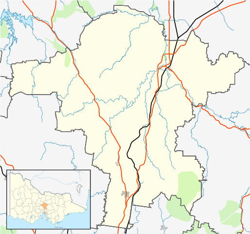
English: Blank map of w:Mitchell Shire, Victoria, Australia, with the following information shown:
Geographic limits:
|
||
| ಆಕರ | ಸ್ವಂತ ಕೆಲಸ | ||
| ಕರ್ತೃ | Cassowary |

ಕಡತದ ಇತಿಹಾಸ
ದಿನ/ಕಾಲ ಒತ್ತಿದರೆ ಆ ಸಮಯದಲ್ಲಿ ಈ ಕಡತದ ವಸ್ತುಸ್ಥಿತಿ ತೋರುತ್ತದೆ.
| ದಿನ/ಕಾಲ | ಕಿರುನೋಟ | ಆಯಾಮಗಳು | ಬಳಕೆದಾರ | ಟಿಪ್ಪಣಿ | |
|---|---|---|---|---|---|
| ಪ್ರಸಕ್ತ | ೦೧:೪೪, ೧೮ ಫೆಬ್ರವರಿ ೨೦೧೧ | | ೫೩೩ × ೪೯೮ (೫೫೧ KB) | Cassowary | {{Information |Description ={{en|1=Blank map of Melbourne, Victoria, Australia, with the following information shown: * LGA boundaries * Coastline, lakes and rivers * Roads and railways * Urban areas * Parks Geographic lim |
ಕಡತ ಬಳಕೆ
ಈ ಕೆಳಗಿನ ಪುಟವು ಈ ಚಿತ್ರಕ್ಕೆ ಸಂಪರ್ಕ ಹೊಂದಿದೆ:
ಜಾಗತಿಕ ಕಡತ ಉಪಯೋಗ
ಈ ಕಡತವನ್ನು ಕೆಳಗಿನ ಬೇರೆ ವಿಕಿಗಳೂ ಉಪಯೋಗಿಸುತ್ತಿವೆ:
- ar.wikipedia.org ಮೇಲೆ ಬಳಕೆ
- ceb.wikipedia.org ಮೇಲೆ ಬಳಕೆ
- en.wikipedia.org ಮೇಲೆ ಬಳಕೆ
- Shire of Mitchell
- Seymour, Victoria
- Avenel, Victoria
- Kilmore, Victoria
- Wallan
- Beveridge, Victoria
- Puckapunyal
- Wandong
- Mia Mia, Victoria
- Broadford, Victoria
- Tallarook
- Pyalong
- Flowerdale, Victoria
- Tooborac
- Emu Flat, Victoria
- Template:Towns in Mitchell Shire
- Heathcote Junction, Victoria
- Clonbinane
- Kilmore East, Victoria
- Mangalore, Victoria
- Module:Location map/data/Australia Victoria Shire of Mitchell/doc
- Trawool
- Mount Fraser (Australia)
- Glenaroua
- Upper Plenty
- Northwood, Victoria
- Moranding
- Reedy Creek, Victoria
- Tyaak
- Waterford Park, Victoria
- Willowmavin
- Module:Location map/data/Australia Victoria Shire of Mitchell
- Sugarloaf Creek, Victoria
- Heathcote South, Victoria
- Sunday Creek, Victoria
- Hume's Pass
- User:Viatori/sandbox
- User:ThylacineHunter/LGA
- fa.wikipedia.org ಮೇಲೆ ಬಳಕೆ
- simple.wikipedia.org ಮೇಲೆ ಬಳಕೆ
- si.wikipedia.org ಮೇಲೆ ಬಳಕೆ
- tr.wikipedia.org ಮೇಲೆ ಬಳಕೆ
- uz.wikipedia.org ಮೇಲೆ ಬಳಕೆ
ಈ ಫೈಲ್ನ ಹೆಚ್ಚು ಜಾಗತಿಕ ಬಳಕೆಯನ್ನು ವೀಕ್ಷಿಸಿ.