ಚಿತ್ರ:TorresStraitIslandsMap.png

ಈ ಮುನ್ನೋಟ ಗಾತ್ರ:೬೦೪ × ೫೯೯ ಪಿಕ್ಸೆಲ್ಗಳು. ಇತರ ರೆಸಲ್ಯೂಶನ್ಗಳು: ೨೪೨ × ೨೪೦ ಪಿಕ್ಸೆಲ್ಗಳು | ೪೮೪ × ೪೮೦ ಪಿಕ್ಸೆಲ್ಗಳು | ೯೨೯ × ೯೨೨ ಪಿಕ್ಸೆಲ್ಗಳು.
ಮೂಲ ಕಡತ (೯೨೯ × ೯೨೨ ಚಿತ್ರಬಿಂದು, ಫೈಲಿನ ಗಾತ್ರ: ೨೮ KB, MIME ಪ್ರಕಾರ: image/png)
ಈ ಫೈಲು ವಿಕಿಮೀಡಿಯ ಕಾಮನ್ಸ್ನಲ್ಲಿ ಇರುವುದು. ಅಲ್ಲಿನ ವಿವರಣೆ ಪುಟವನ್ನೇ ಕೆಳಗೆ ತೋರಿಸಲಾಗಿದೆ. ಕಾಮನ್ಸ್ ಕೃತಿಸ್ವಾಮ್ಯತೆಯಿಂದ ಮುಕ್ತ ಫೈಲುಗಳ ಒಂದು ಆಗರ. ಅಲ್ಲಿ ನೀವೂ ಸಹಕರಿಸಬಹುದು. |
ಸಾರಾಂಶ

|
This locator map image could be re-created using vector graphics as an SVG file. This has several advantages; see Commons:Media for cleanup for more information. If an SVG form of this image is available, please upload it and afterwards replace this template with
{{vector version available|new image name}}.
It is recommended to name the SVG file “TorresStraitIslandsMap.svg”—then the template Vector version available (or Vva) does not need the new image name parameter. |
| ವಿವರ |
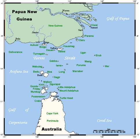
A map of the Torres Strait Islands. I have endeavoured to use native names wherever I could find them. If you can suggest ways in which this map could be made more up to date, don't hesitate to leave me a message to that effect. This map's source is here, with the uploader's modifications, and the GMT homepage says that the tools are released under the GNU General Public License. |
| ದಿನಾಂಕ | ಏಪ್ರಿಲ್ ೧೮, ೨೦೦೬ (original upload date) |
| ಆಕರ | Transferred from en.wikipedia to Commons. |
| ಕರ್ತೃ | Kelisi at ಇಂಗ್ಲಿಷ್ ವಿಕಿಪೀಡಿಯ |
| ಇತರೆ ಆವೃತ್ತಿಗಳು | Image:TorresStraitIslandsMap (zh).png |
.png)
ಪರವಾನಗಿ
Kelisi from en.wikipedia.org, the copyright holder of this work, hereby publishes it under the following license:
| ಈ ಕಡತ ಕ್ರಿಯೇಟಿವ್ ಕಾಮನ್ಸ್ Attribution -Share Alike 3.0 Unported ಪರವಾನಗಿ ಹೊಂದಿದೆ. Subject to disclaimers. | ||
| ವೈಶಿಷ್ಟ್ಯ: Kelisi from en.wikipedia.org | ||
| ||
| This licensing tag was added to this file as part of the GFDL licensing update. |

|
GNU ಉಚಿತ ಡಾಕ್ಯುಮೆಂಟೇಶನ್ ಪರವಾನಗಿ, ಆವೃತ್ತಿಯ ನಿಯಮಗಳ ಅಡಿಯಲ್ಲಿ ಈ ಡಾಕ್ಯುಮೆಂಟ್ ಅನ್ನು ನಕಲಿಸಲು, ವಿತರಿಸಲು ಮತ್ತು/ಅಥವಾ ಮಾರ್ಪಡಿಸಲು ಅನುಮತಿಯನ್ನು ನೀಡಲಾಗಿದೆ. 1.2 ಅಥವಾ ಯಾವುದೇ ನಂತರದ ಆವೃತ್ತಿಯನ್ನು ಉಚಿತ ಸಾಫ್ಟ್ವೇರ್ ಫೌಂಡೇಶನ್ ಪ್ರಕಟಿಸಿದೆ; ಯಾವುದೇ ಅಸ್ಥಿರ ವಿಭಾಗಗಳಿಲ್ಲದೆ, ಮುಖ ಪಠ್ಯಗಳಿಲ್ಲ ಮತ್ತು ಹಿಂದಿನ ಕವರ್ ಪಠ್ಯಗಳಿಲ್ಲ. ಪರವಾನಗಿಯ ಪ್ರತಿಯನ್ನು GNU ಉಚಿತ ಡಾಕ್ಯುಮೆಂಟೇಶನ್ ಪರವಾನಗಿ ಎಂಬ ವಿಭಾಗದಲ್ಲಿ ಸೇರಿಸಲಾಗಿದೆ. Subject to disclaimers. |
Original upload log
The original description page was here. All following user names refer to en.wikipedia.
- 2006-04-19 00:55 Kelisi 929×922×8 (28510 bytes)
- 2006-04-18 03:38 Kelisi 929×922×8 (28133 bytes) A map of the Torres Strait Islands. I have endeavoured to use native names wherever I could find them. If you can suggest ways in which this map could be made more up to date, don't hesitate to leave me a message to that effect. This map's source is [htt
ಕಡತದ ಇತಿಹಾಸ
ದಿನ/ಕಾಲ ಒತ್ತಿದರೆ ಆ ಸಮಯದಲ್ಲಿ ಈ ಕಡತದ ವಸ್ತುಸ್ಥಿತಿ ತೋರುತ್ತದೆ.
| ದಿನ/ಕಾಲ | ಕಿರುನೋಟ | ಆಯಾಮಗಳು | ಬಳಕೆದಾರ | ಟಿಪ್ಪಣಿ | |
|---|---|---|---|---|---|
| ಪ್ರಸಕ್ತ | ೧೨:೧೨, ೧೩ ಜನವರಿ ೨೦೨೨ | | ೯೨೯ × ೯೨೨ (೨೮ KB) | Kelisi | Reverted to version as of 00:09, 1 May 2007 (UTC) Hardly; those two colours are closer to each other. |
| ೨೩:೨೯, ೬ ಅಕ್ಟೋಬರ್ ೨೦೨೧ |  | ೯೨೯ × ೯೨೨ (೩೧ KB) | Claude Zygiel | Better contrast | |
| ೦೫:೩೯, ೧ ಮೇ ೨೦೦೭ |  | ೯೨೯ × ೯೨೨ (೨೮ KB) | Stanmar | {{Information |Description=A map of the Torres Strait Islands. I have endeavoured to use native names wherever I could find them. If you can suggest ways in which this map could be made more up to date, don't hesitate to leave me a message to that effect. |
ಕಡತ ಬಳಕೆ
ಈ ಕೆಳಗಿನ ಪುಟವು ಈ ಚಿತ್ರಕ್ಕೆ ಸಂಪರ್ಕ ಹೊಂದಿದೆ:
ಜಾಗತಿಕ ಕಡತ ಉಪಯೋಗ
ಈ ಕಡತವನ್ನು ಕೆಳಗಿನ ಬೇರೆ ವಿಕಿಗಳೂ ಉಪಯೋಗಿಸುತ್ತಿವೆ:
- af.wikipedia.org ಮೇಲೆ ಬಳಕೆ
- als.wikipedia.org ಮೇಲೆ ಬಳಕೆ
- ar.wikipedia.org ಮೇಲೆ ಬಳಕೆ
- azb.wikipedia.org ಮೇಲೆ ಬಳಕೆ
- ba.wikipedia.org ಮೇಲೆ ಬಳಕೆ
- bg.wikipedia.org ಮೇಲೆ ಬಳಕೆ
- bn.wikipedia.org ಮೇಲೆ ಬಳಕೆ
- br.wikipedia.org ಮೇಲೆ ಬಳಕೆ
- ca.wikipedia.org ಮೇಲೆ ಬಳಕೆ
- ceb.wikipedia.org ಮೇಲೆ ಬಳಕೆ
- cs.wikipedia.org ಮೇಲೆ ಬಳಕೆ
- cy.wikipedia.org ಮೇಲೆ ಬಳಕೆ
- da.wikipedia.org ಮೇಲೆ ಬಳಕೆ
- de.wikipedia.org ಮೇಲೆ ಬಳಕೆ
- Torres-Straße
- Prince-of-Wales-Insel (Queensland)
- Torres-Straits-Expedition
- Bellevue-Inseln
- Mabuiag
- Talbot-Inseln
- Boigu
- Flagge der Torres-Strait-Insulaner
- Manar-Inseln
- Thursday Island
- Horn Island (Torres Strait)
- Saibai
- Thursday-Inseln
- The Three Sisters (Torres Strait)
- Dauan
- Bet Island
- Poll Island
- Sue Island
- Murray-Inseln
- Murray Island
- Badu Island
- Moa Island
- Coconut Island (Australien)
- Yam Island
- Hammond Island
- Goods Island
- Friday Island (Torres Strait)
ಈ ಫೈಲ್ನ ಹೆಚ್ಚು ಜಾಗತಿಕ ಬಳಕೆಯನ್ನು ವೀಕ್ಷಿಸಿ.