ಚಿತ್ರ:Location UK EU Europe.png
ಈ ಮುನ್ನೋಟ ಗಾತ್ರ:೭೧೪ × ೬೦೦ ಪಿಕ್ಸೆಲ್ಗಳು. ಇತರ ರೆಸಲ್ಯೂಶನ್ಗಳು: ೨೮೬ × ೨೪೦ ಪಿಕ್ಸೆಲ್ಗಳು | ೫೭೨ × ೪೮೦ ಪಿಕ್ಸೆಲ್ಗಳು | ೯೧೫ × ೭೬೮ ಪಿಕ್ಸೆಲ್ಗಳು | ೧,೨೧೯ × ೧,೦೨೪ ಪಿಕ್ಸೆಲ್ಗಳು | ೨,೦೪೮ × ೧,೭೨೦ ಪಿಕ್ಸೆಲ್ಗಳು.
ಮೂಲ ಕಡತ (೨,೦೪೮ × ೧,೭೨೦ ಚಿತ್ರಬಿಂದು, ಫೈಲಿನ ಗಾತ್ರ: ೫೯೭ KB, MIME ಪ್ರಕಾರ: image/png)
ಈ ಫೈಲು ವಿಕಿಮೀಡಿಯ ಕಾಮನ್ಸ್ನಲ್ಲಿ ಇರುವುದು. ಅಲ್ಲಿನ ವಿವರಣೆ ಪುಟವನ್ನೇ ಕೆಳಗೆ ತೋರಿಸಲಾಗಿದೆ. ಕಾಮನ್ಸ್ ಕೃತಿಸ್ವಾಮ್ಯತೆಯಿಂದ ಮುಕ್ತ ಫೈಲುಗಳ ಒಂದು ಆಗರ. ಅಲ್ಲಿ ನೀವೂ ಸಹಕರಿಸಬಹುದು. |
ಸಾರಾಂಶ
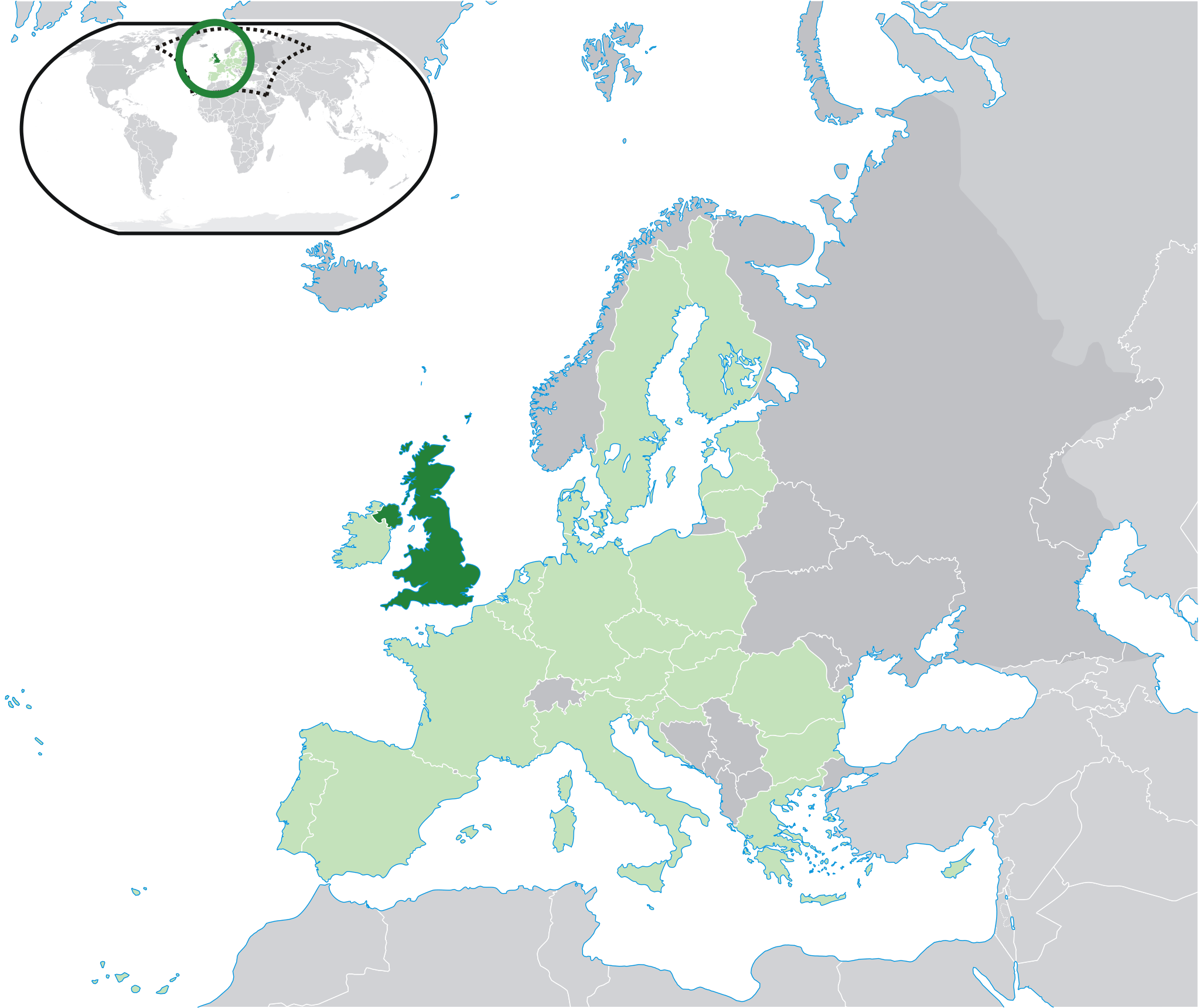
| ವಿವರ | Location map: United Kingdom (dark green) / European Union (light green) / Europe (dark grey); inspired by and consistent with general country locator maps by User:Vardion, et al. | |||
| ದಿನಾಂಕ | ||||
| ಆಕರ | ಸ್ವಂತ ಕೆಲಸ | |||
| ಕರ್ತೃ | Quizimodo | |||
| ಇತರೆ ಆವೃತ್ತಿಗಳು |
Derivative works of this file: Location UK EU Europe 001.svg |


ಪರವಾನಗಿ
| This work has been released into the public domain by its author, I, Quizimodo. This applies worldwide. In some countries this may not be legally possible; if so: I, Quizimodo grants anyone the right to use this work for any purpose, without any conditions, unless such conditions are required by law. |
ಕಡತದ ಇತಿಹಾಸ
ದಿನ/ಕಾಲ ಒತ್ತಿದರೆ ಆ ಸಮಯದಲ್ಲಿ ಈ ಕಡತದ ವಸ್ತುಸ್ಥಿತಿ ತೋರುತ್ತದೆ.
| ದಿನ/ಕಾಲ | ಕಿರುನೋಟ | ಆಯಾಮಗಳು | ಬಳಕೆದಾರ | ಟಿಪ್ಪಣಿ | |
|---|---|---|---|---|---|
| ಪ್ರಸಕ್ತ | ೦೦:೦೦, ೨೯ ಜುಲೈ ೨೦೨೦ | | ೨,೦೪೮ × ೧,೭೨೦ (೫೯೭ KB) | Maphobbyist | Update: South Audan border |
| ೨೦:೩೦, ೧ ಅಕ್ಟೋಬರ್ ೨೦೧೪ |  | ೨,೦೪೮ × ೧,೭೨೦ (೪೧೩ KB) | Maphobbyist | Update: Croatia | |
| ೦೯:೧೭, ೧೦ ಜುಲೈ ೨೦೦೮ |  | ೨,೦೪೮ × ೧,೭೨೦ (೨೬೧ KB) | Pureditor | Reverted to version as of 13:11, 4 July 2007 | |
| ೨೩:೩೪, ೨೩ ಜೂನ್ ೨೦೦೮ |  | ೨,೦೪೮ × ೧,೭೨೦ (೪೧೩ KB) | IJA | minor | |
| ೧೮:೪೧, ೪ ಜುಲೈ ೨೦೦೭ |  | ೨,೦೪೮ × ೧,೭೨೦ (೨೬೧ KB) | Quizimodo~commonswiki | image (updated) | |
| ೧೮:೩೩, ೪ ಜುಲೈ ೨೦೦೭ |  | ೨,೦೪೮ × ೧,೭೨೦ (೨೬೧ KB) | Quizimodo~commonswiki | image (updated) | |
| ೦೯:೪೪, ೩೦ ಜೂನ್ ೨೦೦೭ |  | ೨,೦೫೬ × ೧,೭೨೭ (೨೩೫ KB) | Quizimodo~commonswiki | updated map w/blue coastlines, Anglesey | |
| ೦೬:೩೧, ೧೮ ಜೂನ್ ೨೦೦೭ |  | ೨,೦೫೬ × ೧,೭೧೦ (೧೭೬ KB) | Quizimodo~commonswiki | image (updated) | |
| ೧೬:೨೬, ೧೭ ಜೂನ್ ೨೦೦೭ |  | ೨,೦೫೬ × ೧,೭೧೦ (೨೨೯ KB) | Quizimodo~commonswiki | {{Information |Description=Location map: United Kingdom (dark green) / European Union (light green) / Europe (dark grey); inspired by and consistent with general country locator maps by User:Vardion, et al |Source=self-made |Date=17 June 2007 |Author= [[U |
ಕಡತ ಬಳಕೆ
ಈ ಫೈಲನ್ನು ಬಳಸುವ ಯಾವ ಪುಟಗಳೂ ಇಲ್ಲ.
ಜಾಗತಿಕ ಕಡತ ಉಪಯೋಗ
ಈ ಕಡತವನ್ನು ಕೆಳಗಿನ ಬೇರೆ ವಿಕಿಗಳೂ ಉಪಯೋಗಿಸುತ್ತಿವೆ:
- bi.wikipedia.org ಮೇಲೆ ಬಳಕೆ
- bn.wikibooks.org ಮೇಲೆ ಬಳಕೆ
- bo.wikipedia.org ಮೇಲೆ ಬಳಕೆ
- cbk-zam.wikipedia.org ಮೇಲೆ ಬಳಕೆ
- dz.wikipedia.org ಮೇಲೆ ಬಳಕೆ
- en.wikibooks.org ಮೇಲೆ ಬಳಕೆ
- en.wikinews.org ಮೇಲೆ ಬಳಕೆ
- eu.wiktionary.org ಮೇಲೆ ಬಳಕೆ
- fr.wikibooks.org ಮೇಲೆ ಬಳಕೆ
- fr.wiktionary.org ಮೇಲೆ ಬಳಕೆ
- gu.wikipedia.org ಮೇಲೆ ಬಳಕೆ
- id.wikibooks.org ಮೇಲೆ ಬಳಕೆ
- krc.wikipedia.org ಮೇಲೆ ಬಳಕೆ
- mai.wikipedia.org ಮೇಲೆ ಬಳಕೆ
- nl.wikibooks.org ಮೇಲೆ ಬಳಕೆ
- pnb.wikipedia.org ಮೇಲೆ ಬಳಕೆ
- pt.wikibooks.org ಮೇಲೆ ಬಳಕೆ
- ro.wikibooks.org ಮೇಲೆ ಬಳಕೆ
- ro.wikinews.org ಮೇಲೆ ಬಳಕೆ
- Doi morți în exploziile de la Londra
- Papandreou declară că Grecia are nevoie de sprijin, nu de împrumuturi
- Format:Marea Britanie
- Mii de persoane au protestat împotriva arestării lui Ganic
- Marea Britanie îl eliberează pe Ganic pe cauțiune
- O curte din Londra amână audierea în cazul Ganic
- Wikipedia va fi relansată pe 5 aprilie
- Livrări suspendate din cauza unei pisici care a atacat poștașii
- Chelsea FC a câștigat campionatul Angliei
- Albania și Marea Britanie semnează un acord privitor la schimburile de informații
- Huliganii din Anglia s-au potolit - fapte, ipoteze, concluzii
- A început Turneul de Tenis de la Wimbledon. Rezultatele românilor în prima zi
- Simona Halep s-a calificat în turul doi la Wimbledon
- Rezultate Wimbledon: ziua a doua
- Rezultate Wimbledon. Ziua a treia
- Simona Halep a pierdut în turul doi la Wimbledon
- Rezultate Wimbledon 2013: Andy Murray, primul britanic care câștigă titlul la Wimbledon după 77 de ani
- Fiica prințului William și a lui Kate va purta numele Charlotte
- Prim-ministrul Marii Britanii, David Cameron, cere lovituri aeriene britanice contra ISIS în Siria
- Regatul Unit a început loviturile aeriene împotriva ISIS în Siria
- sah.wikipedia.org ಮೇಲೆ ಬಳಕೆ
- shn.wikibooks.org ಮೇಲೆ ಬಳಕೆ
- sn.wikipedia.org ಮೇಲೆ ಬಳಕೆ
- su.wikipedia.org ಮೇಲೆ ಬಳಕೆ
- tpi.wikipedia.org ಮೇಲೆ ಬಳಕೆ
- ug.wikipedia.org ಮೇಲೆ ಬಳಕೆ
- yo.wikipedia.org ಮೇಲೆ ಬಳಕೆ