ಚಿತ್ರ:LocationSouthAfrica.png
ಇದಕ್ಕಿಂತ ಹೆಚ್ಚಿನ ವಿವರವಾದ ನೋಟ ಇಲ್ಲ.
LocationSouthAfrica.png (೨೫೦ × ೧೧೫ ಚಿತ್ರಬಿಂದು, ಫೈಲಿನ ಗಾತ್ರ: ೫ KB, MIME ಪ್ರಕಾರ: image/png)
ಈ ಫೈಲು ವಿಕಿಮೀಡಿಯ ಕಾಮನ್ಸ್ನಲ್ಲಿ ಇರುವುದು. ಅಲ್ಲಿನ ವಿವರಣೆ ಪುಟವನ್ನೇ ಕೆಳಗೆ ತೋರಿಸಲಾಗಿದೆ. ಕಾಮನ್ಸ್ ಕೃತಿಸ್ವಾಮ್ಯತೆಯಿಂದ ಮುಕ್ತ ಫೈಲುಗಳ ಒಂದು ಆಗರ. ಅಲ್ಲಿ ನೀವೂ ಸಹಕರಿಸಬಹುದು. |
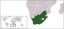
Afrikaans: 'n Geografiese kaart om die posisie van Suid-Afrika aan te dui.
English: Location map for South Africa.
Čeština: Poloha Jihoafrické republiky.
Originally created for English Wikipedia by Vardion.
| |
This work has been released into the public domain by its author, Vardion, at the [[::|ಇಂಗ್ಲಿಷ್ ವಿಕಿಪೀಡಿಯ]] project. This applies worldwide. In case this is not legally possible: |

|
File:LocationSouthAfrica.svg is a vector version of this file. It should be used in place of this PNG file when not inferior.
File:LocationSouthAfrica.png → File:LocationSouthAfrica.svg
For more information, see Help:SVG. |
 |
ಕಡತದ ಇತಿಹಾಸ
ದಿನ/ಕಾಲ ಒತ್ತಿದರೆ ಆ ಸಮಯದಲ್ಲಿ ಈ ಕಡತದ ವಸ್ತುಸ್ಥಿತಿ ತೋರುತ್ತದೆ.
| ದಿನ/ಕಾಲ | ಕಿರುನೋಟ | ಆಯಾಮಗಳು | ಬಳಕೆದಾರ | ಟಿಪ್ಪಣಿ | |
|---|---|---|---|---|---|
| ಪ್ರಸಕ್ತ | ೦೮:೫೩, ೧೩ ಡಿಸೆಂಬರ್ ೨೦೦೪ | | ೨೫೦ × ೧೧೫ (೫ KB) | EugeneZelenko | Location map for the South Africa.<br/>Originally created for English Wikipedia by Vardion.<br/>{{PD}}<br/>Category:Country locator maps |
ಕಡತ ಬಳಕೆ
ಈ ಕೆಳಗಿನ ಪುಟವು ಈ ಚಿತ್ರಕ್ಕೆ ಸಂಪರ್ಕ ಹೊಂದಿದೆ:
ಜಾಗತಿಕ ಕಡತ ಉಪಯೋಗ
ಈ ಕಡತವನ್ನು ಕೆಳಗಿನ ಬೇರೆ ವಿಕಿಗಳೂ ಉಪಯೋಗಿಸುತ್ತಿವೆ:
- ar.wikinews.org ಮೇಲೆ ಬಳಕೆ
- قالب:جنوب أفريقيا
- جنوب أفريقيا تفرض ملصقات لتمييز بضائع الأراضي المحتلة عن المصنوعة في إسرائيل
- قيادة الشرطة في بيترماريتزبرغ توقف اختبارات القبول بعد وفاة سبعة مرشحين
- رئيس جنوب إفريقيا يدعو مواطنيه للامتناع عن زيارة "إسرائيل"
- حماس تشيد بدعوة رئيس جنوب إفريقيا عدم زيارة "إسرائيل"
- اعتماد المجلس الوطني الفلسطيني عضواً مراقباً في البرلمان الإفريقي
- جنوب إفريقيا تعلن مقاطعتها القمة الإفريقية-"الإسرائيلية"
- حفيد مانديلا: فلسطين تعاني من أسوأ أنواع الأبارتهايد
- أغنية كأس أمم أفريقيا تحتفي بالسلام
- bpy.wikipedia.org ಮೇಲೆ ಬಳಕೆ
- br.wikipedia.org ಮೇಲೆ ಬಳಕೆ
- br.wiktionary.org ಮೇಲೆ ಬಳಕೆ
- ca.wikipedia.org ಮೇಲೆ ಬಳಕೆ
- ceb.wikipedia.org ಮೇಲೆ ಬಳಕೆ
- de.wikipedia.org ಮೇಲೆ ಬಳಕೆ
- Bontebok-Nationalpark
- Addo-Elefanten-Nationalpark
- Mountain-Zebra-Nationalpark
- West-Coast-Nationalpark
- ISimangaliso-Wetland-Park
- Augrabiesfälle
- Tsitsikamma-Nationalpark
- Goegap Nature Reserve
- Namaqua-Nationalpark
- Anysberg Nature Reserve
- Tankwa-Karoo-Nationalpark
- De Mond Nature Reserve
- Oorlogskloof Nature Reserve
- Grootvadersbosch Nature Reserve
- Rocherpan Nature Reserve
- Golden-Gate-Highlands-Nationalpark
- Akkerendam Nature Reserve
- Marloth Nature Reserve
- De Hoop Nature Reserve
- Gamkaberg Nature Reserve
- Bird Island Nature Reserve
- Midmar Nature Reserve
- Hluhluwe-iMfolozi-Park
- Karoo-Nationalpark
- Knysna National Lake Area
- Mapungubwe-Nationalpark
- Marakele-Nationalpark
- Tafelberg-Nationalpark
- Wilderness-Nationalpark
- Agulhas-Nationalpark
- Caledon Nature Reserve (Freistaat)
- Mokala-Nationalpark
- Camdeboo-Nationalpark
- Garden-Route-Nationalpark
- Tembe Elephant Park
ಈ ಫೈಲ್ನ ಹೆಚ್ಚು ಜಾಗತಿಕ ಬಳಕೆಯನ್ನು ವೀಕ್ಷಿಸಿ.