ಚಿತ್ರ:LocationSamoa.png
ಇದಕ್ಕಿಂತ ಹೆಚ್ಚಿನ ವಿವರವಾದ ನೋಟ ಇಲ್ಲ.
LocationSamoa.png (೨೪೮ × ೧೫೬ ಚಿತ್ರಬಿಂದು, ಫೈಲಿನ ಗಾತ್ರ: ೩ KB, MIME ಪ್ರಕಾರ: image/png)
ಈ ಫೈಲು ವಿಕಿಮೀಡಿಯ ಕಾಮನ್ಸ್ನಲ್ಲಿ ಇರುವುದು. ಅಲ್ಲಿನ ವಿವರಣೆ ಪುಟವನ್ನೇ ಕೆಳಗೆ ತೋರಿಸಲಾಗಿದೆ. ಕಾಮನ್ಸ್ ಕೃತಿಸ್ವಾಮ್ಯತೆಯಿಂದ ಮುಕ್ತ ಫೈಲುಗಳ ಒಂದು ಆಗರ. ಅಲ್ಲಿ ನೀವೂ ಸಹಕರಿಸಬಹುದು. |
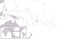
Location map for the Samoa.
Originally created for English Wikipedia by Vardion.
| |
This work has been released into the public domain by its author, Vardion, at the ಇಂಗ್ಲಿಷ್ ವಿಕಿಪೀಡಿಯ project. This applies worldwide. In case this is not legally possible: |
ಕಡತದ ಇತಿಹಾಸ
ದಿನ/ಕಾಲ ಒತ್ತಿದರೆ ಆ ಸಮಯದಲ್ಲಿ ಈ ಕಡತದ ವಸ್ತುಸ್ಥಿತಿ ತೋರುತ್ತದೆ.
| ದಿನ/ಕಾಲ | ಕಿರುನೋಟ | ಆಯಾಮಗಳು | ಬಳಕೆದಾರ | ಟಿಪ್ಪಣಿ | |
|---|---|---|---|---|---|
| ಪ್ರಸಕ್ತ | ೦೫:೫೮, ೫ ಸೆಪ್ಟೆಂಬರ್ ೨೦೧೦ | | ೨೪೮ × ೧೫೬ (೩ KB) | Ras67 | cropped and squeezed |
| ೨೦:೫೦, ೨೧ ಡಿಸೆಂಬರ್ ೨೦೦೪ |  | ೨೫೦ × ೧೫೮ (೬ KB) | EugeneZelenko | Location map for the Samoa.<br/>Originally created for English Wikipedia by Vardion.<br/>{{PD}}<br/>Category:Country locator maps |
ಕಡತ ಬಳಕೆ
ಈ ಕೆಳಗಿನ ಪುಟವು ಈ ಚಿತ್ರಕ್ಕೆ ಸಂಪರ್ಕ ಹೊಂದಿದೆ:
ಜಾಗತಿಕ ಕಡತ ಉಪಯೋಗ
ಈ ಕಡತವನ್ನು ಕೆಳಗಿನ ಬೇರೆ ವಿಕಿಗಳೂ ಉಪಯೋಗಿಸುತ್ತಿವೆ:
- af.wikipedia.org ಮೇಲೆ ಬಳಕೆ
- ar.wikipedia.org ಮೇಲೆ ಬಳಕೆ
- قرار مجلس الأمن التابع للأمم المتحدة رقم 399
- معاملة المثليين في ساموا
- مستخدم:جار الله/قائمة صور مقالات العلاقات الثنائية
- العلاقات الأمريكية الساموية
- العلاقات الأنغولية الساموية
- العلاقات الساموية الكورية الجنوبية
- العلاقات الإريترية الساموية
- العلاقات الساموية السويسرية
- العلاقات الألمانية الساموية
- العلاقات الساموية الليختنشتانية
- العلاقات البوليفية الساموية
- العلاقات الساموية الموزمبيقية
- العلاقات الألبانية الساموية
- العلاقات البلجيكية الساموية
- العلاقات الإثيوبية الساموية
- العلاقات البيلاروسية الساموية
- العلاقات الساموية الطاجيكستانية
- العلاقات الروسية الساموية
- العلاقات الرومانية الساموية
- العلاقات الأرجنتينية الساموية
- العلاقات الساموية الغامبية
- العلاقات الساموية القبرصية
- العلاقات الساموية السيراليونية
- العلاقات الساموية النيبالية
- العلاقات الساموية الليبيرية
- العلاقات التشيكية الساموية
- العلاقات الساموية الميانمارية
- العلاقات الساموية الكندية
- العلاقات السعودية الساموية
- العلاقات الزيمبابوية الساموية
- العلاقات الإسرائيلية الساموية
- العلاقات البالاوية الساموية
- العلاقات الساموية المالية
- العلاقات الساموية النيجيرية
- العلاقات اليمنية الساموية
- العلاقات الساموية الفانواتية
- العلاقات الغابونية الساموية
- العلاقات البنمية الساموية
- العلاقات الساموية الكوبية
- العلاقات الجورجية الساموية
- العلاقات التونسية الساموية
- العلاقات الساموية الكورية الشمالية
- العلاقات الهندية الساموية
- العلاقات اليابانية الساموية
- العلاقات الإيطالية الساموية
- العلاقات الساموية الناوروية
- العلاقات الأسترالية الساموية
- العلاقات الزامبية الساموية
- العلاقات الساموية الفيجية
ಈ ಫೈಲ್ನ ಹೆಚ್ಚು ಜಾಗತಿಕ ಬಳಕೆಯನ್ನು ವೀಕ್ಷಿಸಿ.