ಚಿತ್ರ:Chile Exclusive Economic Zones.PNG
ಈ ಮುನ್ನೋಟ ಗಾತ್ರ:೮೦೦ × ೩೯೧ ಪಿಕ್ಸೆಲ್ಗಳು. ಇತರ ರೆಸಲ್ಯೂಶನ್ಗಳು: ೩೨೦ × ೧೫೬ ಪಿಕ್ಸೆಲ್ಗಳು | ೬೪೦ × ೩೧೩ ಪಿಕ್ಸೆಲ್ಗಳು | ೧,೦೨೪ × ೫೦೧ ಪಿಕ್ಸೆಲ್ಗಳು | ೧,೨೮೦ × ೬೨೬ ಪಿಕ್ಸೆಲ್ಗಳು | ೨,೪೧೦ × ೧,೧೭೮ ಪಿಕ್ಸೆಲ್ಗಳು.
ಮೂಲ ಕಡತ (೨,೪೧೦ × ೧,೧೭೮ ಚಿತ್ರಬಿಂದು, ಫೈಲಿನ ಗಾತ್ರ: ೧೫೪ KB, MIME ಪ್ರಕಾರ: image/png)
ಈ ಫೈಲು ವಿಕಿಮೀಡಿಯ ಕಾಮನ್ಸ್ನಲ್ಲಿ ಇರುವುದು. ಅಲ್ಲಿನ ವಿವರಣೆ ಪುಟವನ್ನೇ ಕೆಳಗೆ ತೋರಿಸಲಾಗಿದೆ. ಕಾಮನ್ಸ್ ಕೃತಿಸ್ವಾಮ್ಯತೆಯಿಂದ ಮುಕ್ತ ಫೈಲುಗಳ ಒಂದು ಆಗರ. ಅಲ್ಲಿ ನೀವೂ ಸಹಕರಿಸಬಹುದು. |
ಸಾರಾಂಶ
| ವಿವರ |
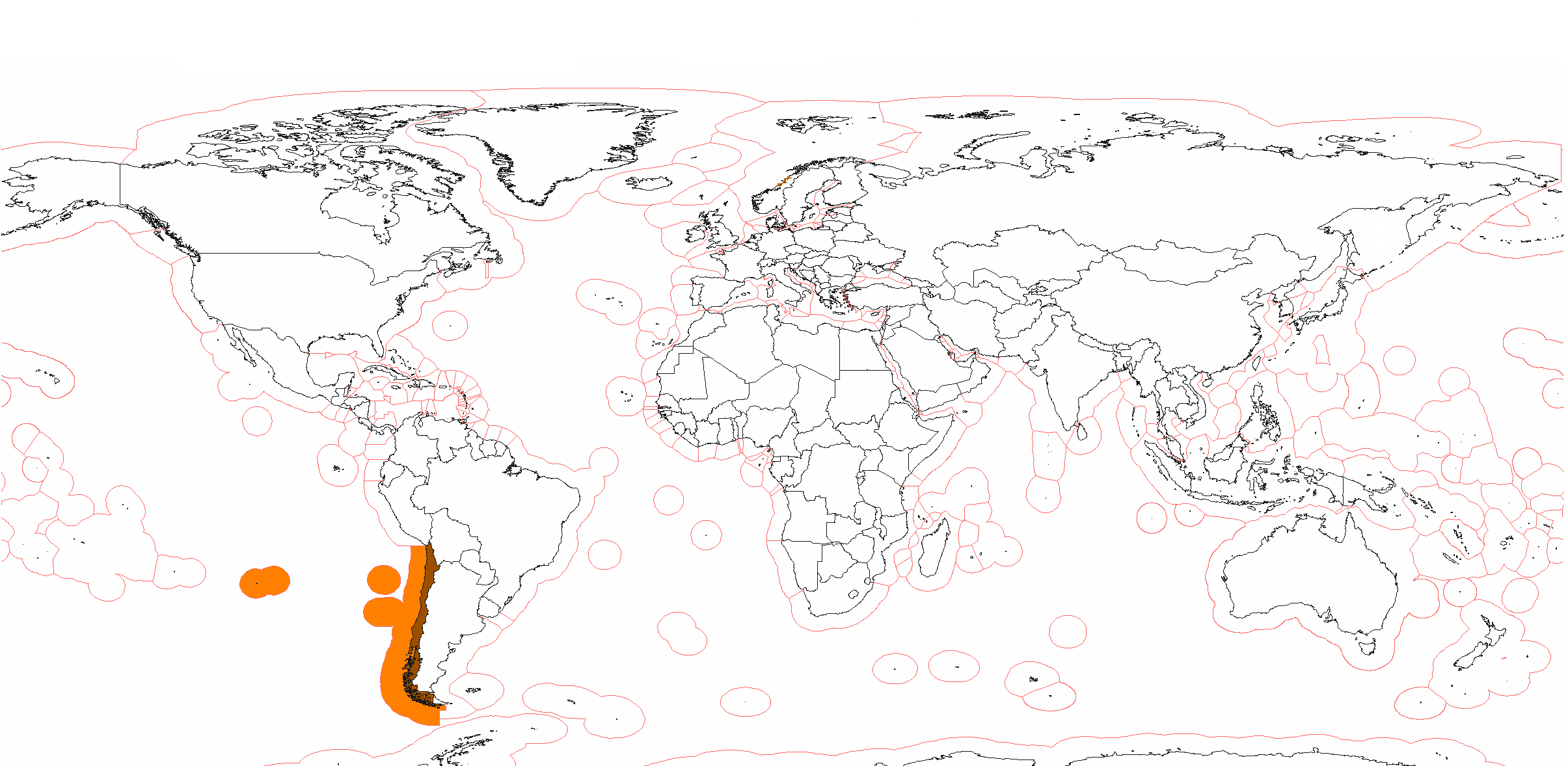
English: A colored map showing the exclusive economic zones of Chile. |
| ದಿನಾಂಕ | |
| ಆಕರ | ಸ್ವಂತ ಕೆಲಸ |
| ಕರ್ತೃ | Cateatcat |
ಪರವಾನಗಿ
| I, the copyright holder of this work, release this work into the public domain. This applies worldwide. In some countries this may not be legally possible; if so: I grant anyone the right to use this work for any purpose, without any conditions, unless such conditions are required by law. |
ಕಡತದ ಇತಿಹಾಸ
ದಿನ/ಕಾಲ ಒತ್ತಿದರೆ ಆ ಸಮಯದಲ್ಲಿ ಈ ಕಡತದ ವಸ್ತುಸ್ಥಿತಿ ತೋರುತ್ತದೆ.
| ದಿನ/ಕಾಲ | ಕಿರುನೋಟ | ಆಯಾಮಗಳು | ಬಳಕೆದಾರ | ಟಿಪ್ಪಣಿ | |
|---|---|---|---|---|---|
| ಪ್ರಸಕ್ತ | ೨೦:೨೫, ೨೫ ಜುಲೈ ೨೦೨೦ | | ೨,೪೧೦ × ೧,೧೭೮ (೧೫೪ KB) | Maphobbyist | Added the borders of South Sudan and Montengro, and the Sea of Okhotsk is now wholly within the Russian EEZ. |
| ೦೨:೦೮, ೨೮ ಏಪ್ರಿಲ್ ೨೦೦೯ |  | ೨,೪೧೦ × ೧,೧೭೮ (೧೭೯ KB) | Cateatcat | {{Information |Description={{en|1=A colored map showing the exclusive economic zones of Chile.}} |Source=Own work by uploader |Author=Cateatcat |Date=26 April 2008 |Permission= |other_versions= }} <!--{{ImageUpload|full}}--> |
ಕಡತ ಬಳಕೆ
ಈ ಕೆಳಗಿನ ಪುಟವು ಈ ಚಿತ್ರಕ್ಕೆ ಸಂಪರ್ಕ ಹೊಂದಿದೆ: