ಚಿತ್ರ:AB-towns-highways.png
ಈ ಮುನ್ನೋಟ ಗಾತ್ರ:೪೪೯ × ೬೦೦ ಪಿಕ್ಸೆಲ್ಗಳು. ಇತರ ರೆಸಲ್ಯೂಶನ್ಗಳು: ೧೮೦ × ೨೪೦ ಪಿಕ್ಸೆಲ್ಗಳು | ೫೨೪ × ೭೦೦ ಪಿಕ್ಸೆಲ್ಗಳು.
ಮೂಲ ಕಡತ (೫೨೪ × ೭೦೦ ಚಿತ್ರಬಿಂದು, ಫೈಲಿನ ಗಾತ್ರ: ೬೩ KB, MIME ಪ್ರಕಾರ: image/png)
ಈ ಫೈಲು ವಿಕಿಮೀಡಿಯ ಕಾಮನ್ಸ್ನಲ್ಲಿ ಇರುವುದು. ಅಲ್ಲಿನ ವಿವರಣೆ ಪುಟವನ್ನೇ ಕೆಳಗೆ ತೋರಿಸಲಾಗಿದೆ. ಕಾಮನ್ಸ್ ಕೃತಿಸ್ವಾಮ್ಯತೆಯಿಂದ ಮುಕ್ತ ಫೈಲುಗಳ ಒಂದು ಆಗರ. ಅಲ್ಲಿ ನೀವೂ ಸಹಕರಿಸಬಹುದು. |

|
This road map image could be re-created using vector graphics as an SVG file. This has several advantages; see Commons:Media for cleanup for more information. If an SVG form of this image is available, please upload it and afterwards replace this template with
{{vector version available|new image name}}.
It is recommended to name the SVG file “AB-towns-highways.svg”—then the template Vector version available (or Vva) does not need the new image name parameter. |
ಸಾರಾಂಶ
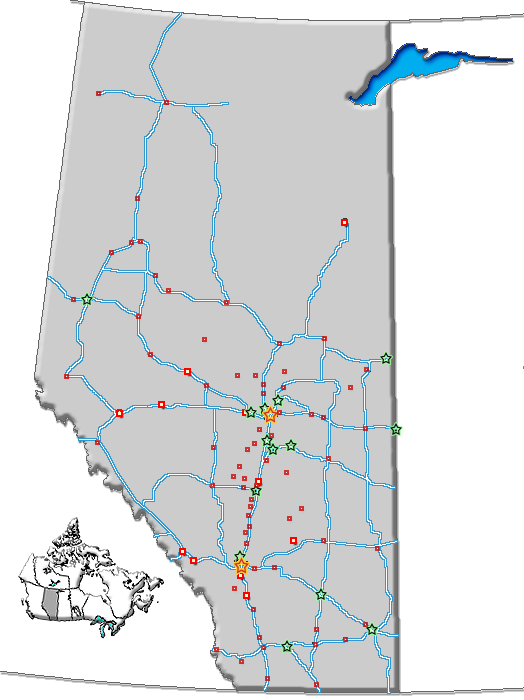
| ವಿವರ | Map of Alberta with cities, towns and highways |
| ದಿನಾಂಕ | |
| ಆಕರ | GIS data |
| ಕರ್ತೃ | Qyd (ಚರ್ಚೆ · ಕಾಣಿಕೆಗಳು) |
| ಅನುಮತಿ (ಈ ಕಡತವನ್ನು ಮರುಬಳಕೆ ಮಾಡಲಾಗುತ್ತಿದೆ) |
All |
| ಇತರೆ ಆವೃತ್ತಿಗಳು | Image:AB-towns-roads.png (inculdes all roads), Image:AB towns+names.png (includes town names), Image:AB-cities-roads.png (cities and highways) |
ಪರವಾನಗಿ
| I, the copyright holder of this work, release this work into the public domain. This applies worldwide. In some countries this may not be legally possible; if so: I grant anyone the right to use this work for any purpose, without any conditions, unless such conditions are required by law. |
ಕಡತದ ಇತಿಹಾಸ
ದಿನ/ಕಾಲ ಒತ್ತಿದರೆ ಆ ಸಮಯದಲ್ಲಿ ಈ ಕಡತದ ವಸ್ತುಸ್ಥಿತಿ ತೋರುತ್ತದೆ.
| ದಿನ/ಕಾಲ | ಕಿರುನೋಟ | ಆಯಾಮಗಳು | ಬಳಕೆದಾರ | ಟಿಪ್ಪಣಿ | |
|---|---|---|---|---|---|
| ಪ್ರಸಕ್ತ | ೦೪:೪೦, ೧ ನವೆಂಬರ್ ೨೦೦೬ | | ೫೨೪ × ೭೦೦ (೬೩ KB) | Qyd | +towns |
| ೦೩:೨೦, ೩೦ ಅಕ್ಟೋಬರ್ ೨೦೦೬ |  | ೫೨೪ × ೭೦೦ (೬೨ KB) | Qyd | add David Thompson highway | |
| ೦೧:೪೨, ೨೬ ಅಕ್ಟೋಬರ್ ೨೦೦೬ |  | ೫೨೪ × ೭೦೦ (೬೨ KB) | Qyd | no legend | |
| ೦೯:೪೧, ೫ ಅಕ್ಟೋಬರ್ ೨೦೦೬ |  | ೫೨೪ × ೭೦೦ (೪೫ KB) | Qyd | {{Information |Description=Map of Alberta with cities, towns and highways |Source=GIS data |Date=Oct 2006 |Author={{User|Qyd}} |Permission=All |other_versions=Image:AB-towns-roads.png (inculdes all roads), Image:AB towns+names.png (includes |
ಕಡತ ಬಳಕೆ
ಈ ಕೆಳಗಿನ 2 ಪುಟಗಳು ಈ ಚಿತ್ರಕ್ಕೆ ಸಂಪರ್ಕ ಹೊಂದಿವೆ:
ಜಾಗತಿಕ ಕಡತ ಉಪಯೋಗ
ಈ ಕಡತವನ್ನು ಕೆಳಗಿನ ಬೇರೆ ವಿಕಿಗಳೂ ಉಪಯೋಗಿಸುತ್ತಿವೆ:
- bg.wikipedia.org ಮೇಲೆ ಬಳಕೆ
- en.wikipedia.org ಮೇಲೆ ಬಳಕೆ
- eo.wikipedia.org ಮೇಲೆ ಬಳಕೆ
- es.wikipedia.org ಮೇಲೆ ಬಳಕೆ
- it.wikipedia.org ಮೇಲೆ ಬಳಕೆ
- ka.wikipedia.org ಮೇಲೆ ಬಳಕೆ
- ro.wikipedia.org ಮೇಲೆ ಬಳಕೆ
- sah.wikipedia.org ಮೇಲೆ ಬಳಕೆ
- uk.wikipedia.org ಮೇಲೆ ಬಳಕೆ